Typhoon "YAGI" will bring strong wind and heavy rainfall to Vietnam and Laos
It is anticipated that Typhoon "YAGI" will move west-northwestward at a speed of 15-20 kilometers per hour, entering the sea area of the Beibu Gulf from late night on the 6th to early morning on the 7th September,2024. "YAGI" will make landfall between Fangchenggang, Guangxi, China, and the northern coast of Vietnam in the afternoon of the 7th September (severe typhoon level, 14-15 grades, 42-48 meters per second), and after that its intensity will gradually weaken.
Affected by "YAGI", from September 6th to 10th, northern Vietnam, northern Laos, northern Thailand, and Myanmar will experience heavy to torrential rainfall from east to west, with some areas receiving extremely heavy rainfall. The accumulated precipitation during this period is expected to be 80-200mm, with parts of northern Vietnam and northern Laos reaching 250-350mm, and locally exceeding 400mm. In addition, from September 7th to 8th, the coastal areas of northern Vietnam will experience gales of 10-12 grades, with local winds reaching 13-14 grades and gusts up to grade 15; the inland areas of northern Vietnam and northern Laos will have winds of 5-6 grades, with gusts of 7-8 grades.
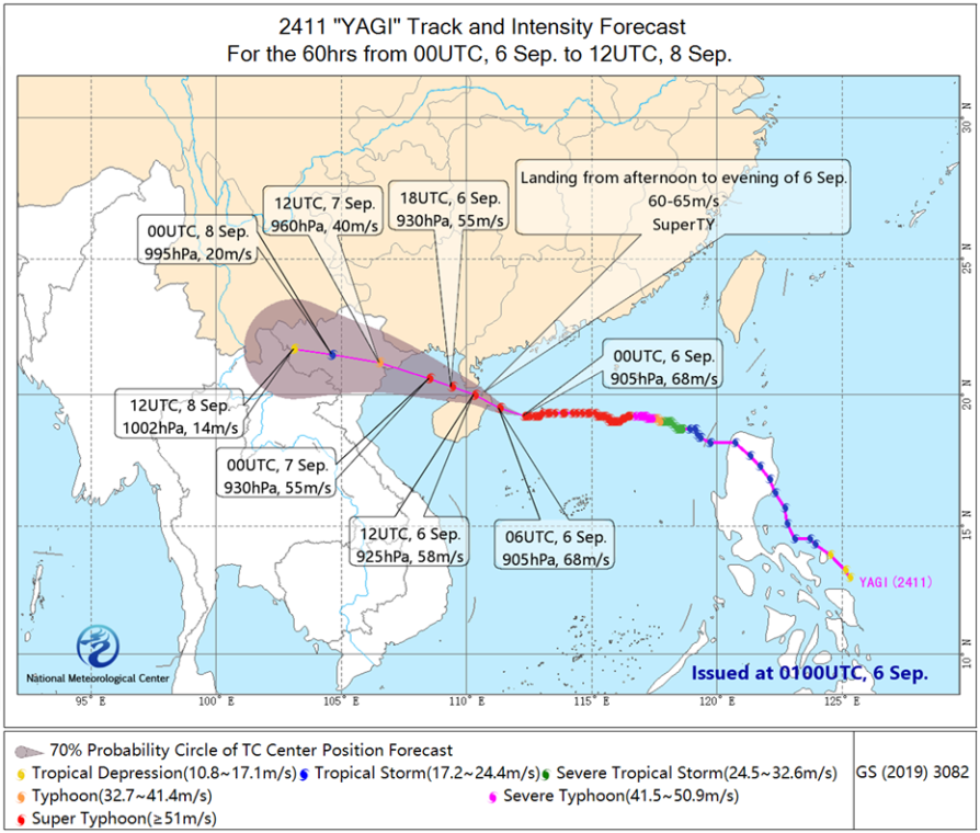
Figure 1 Typhoon "YAGI" Track Forecast
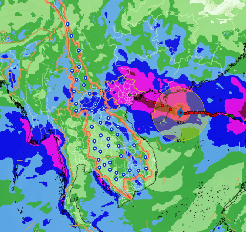
Figure 2. Quantitative precipitation forecast from 0800 LST September 6th to 0800 LST September 9th
![]()
Author: Huang Yiwu, Liu Chao Reviewer: Yang Shunan
English reviewer:Yang Shunan Issue approver:Dai Kan
 京公网安备 11040102700102号 京ICP备05055842-5号
  中文
中文 ພາສາລາວ
 ພາສາໄທ
 ມຽນມາ
ມຽນມາ