
Typhoon "Penha" Brings Severe Rain and Wind to the Philippines
Typhoon "Penha" (Tropical Storm level), the second of the year, made landfall in the Philippines around 3 a.m. today (the 6th), with maximum winds near its center reaching 9 levels (23 meters per second). It is expected that "Penha" will continue to move westward at a speed of approximately 20-25 kilometers per hour, entering the Sulu Sea, where its intensity will gradually weaken. By the 8th, it will move into the southeastern part of the South China Sea and subsequently weaken and dissipate (Figure 1). Affected by this, the Philippines will experience moderate to heavy rain, with localized heavy downpours or intense rain, accumulating to 100-150 mm, and exceeding 250 mm in some areas (Figure 2). Attention should be given to potential secondary disasters such as flash floods and urban waterlogging.
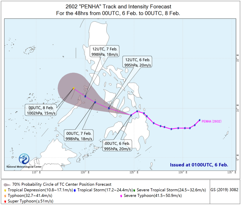
Figure 1 48-hour Probabilistic Track Forecast for Typhoon "Penha" (From 00:00 February 6 to 00:00 February 8,UTC)
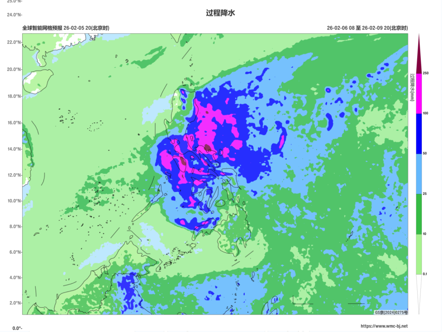
Figure 2 Forecasted Accumulated Precipitation from 00:00 UTC on February 6 to 12:00 UTC on February 9, 2026 (Shaded, Units: mm)
https://www.wmc-bj.net
![]()
Author: Zhang Suzhao, Jia Li Reviewer: Ma Jie, Xiang Chunyi
English reviewer:Wang Yi Issue approver:Dai Kan