Tropical Cyclones "Maila" and "Vaianu" to Impact Multiple Countries in Oceania
At 08:00 today, the centers of the Southeast Pacific tropical cyclones "Maila" and "Vaianu" were located at 9.0°S, 155.8°E and 22.2°S, 177.4°E, respectively. Their intensities were classified as a Category 5 severe tropical cyclone (with maximum wind speeds of 57 meters per second) and a Category 3 severe tropical cyclone (with maximum wind speeds of 33 meters per second), as shown in Figure 1.
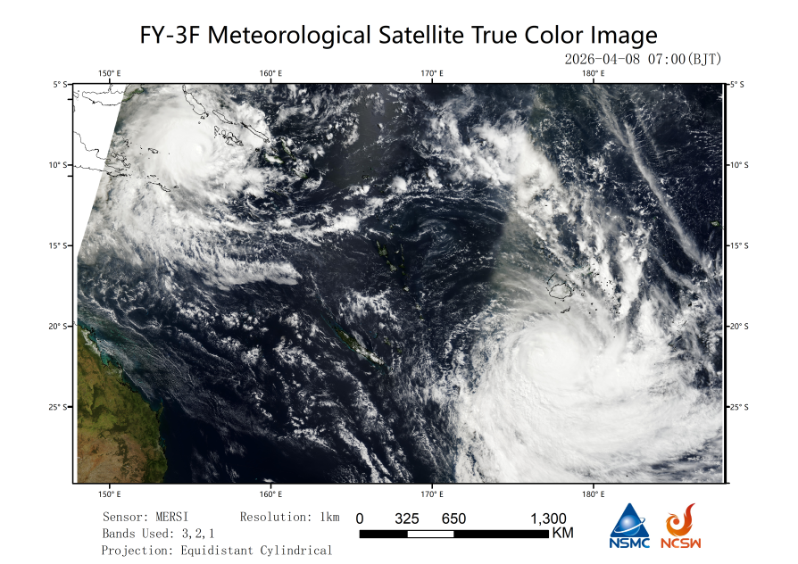
Figure 1: True Color Composite Image from the FY-3F Meteorological Satellite (April 8, 07:00 Beijing Time)
The FY-3D/E/F meteorological satellite precipitation fusion products indicate (Figure 2) that between 8:00 AM and 8:00 PM (Beijing time) on the 7th, the 12-hour cumulative rainfall associated with the outer regions of "Maila" and "Vaianu" largely exceeded 100 mm. In particular, the northern side of "Maila's" center and the central and eastern areas of "Vaianu's" center experienced the highest 12-hour cumulative rainfall, surpassing 250 mm.
Figure 2: FY-3/E/F Meteorological Satellite Precipitation Fusion Product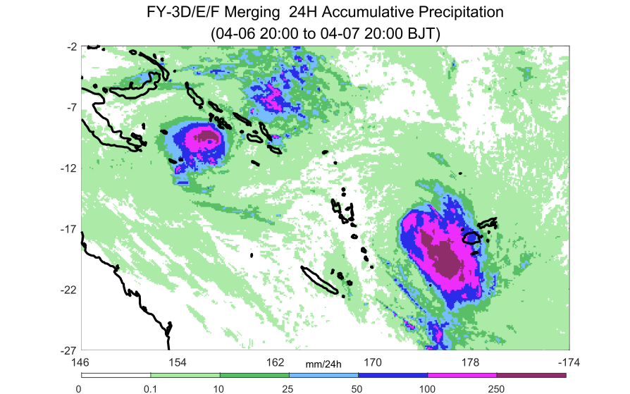
According to the forecast from the Central Meteorological Observatory, "Maila" will continue to move west-southwest at a speed of 5-10 kilometers per hour, with its intensity gradually weakening. Meanwhile, "Vaianu" will move south-southeast at a speed of 20 kilometers per hour, also experiencing a gradual decrease in intensity. Affected by "Maila," heavy to torrential rain is expected in the Solomon Islands, eastern Papua New Guinea, and the surrounding seas from April 8 to 11, with localized extremely heavy downpours. These rains will be accompanied by winds of 7-9 Beaufort scale, with gusts exceeding 11 Beaufort scale (Figure 3). Over the next four days, cumulative rainfall in most of these areas is anticipated to reach 100-200 millimeters, with some regions receiving 250-350 millimeters and localized areas exceeding 400 millimeters (Figure 4). Afterward, "Maila" will slowly move southwestward and is likely to bring rain and wind impacts to the northeastern region of Australia after the 12th. Additionally, from April 11, the outer circulation of "Vaianu" will bring strong winds and rains to the North Island of New Zealand.
Attention should be given to the adverse impacts of the strong winds and heavy rains brought by the tropical cyclone on transportation and infrastructure in the affected maritime areas and related countries. Additionally, localized heavy rainfall may trigger secondary disasters such as flooding, landslides, mudslides, and urban waterlogging.
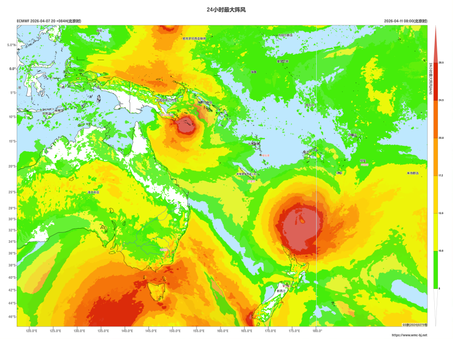
Figure 3: Maximum Gust Wind Speed for 24 Hours as of 08:00 (Beijing Time) on April 11
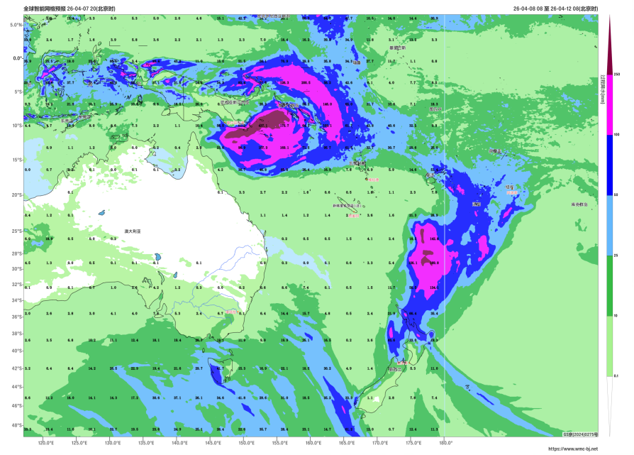
Figure 4: Forecast of Accumulated Precipitation from 08:00 on April 8 to 08:00 on April 12 (Beijing Time) (Unit: mm)
https://www.wmc-bj.net
![]()
Author: Kong Linghan, Zheng Zhaojun, Liu Tao Reviewer: Zhou Ningfang
English reviewer:Wang Yi Issue approver:Dai Kan