
Canada and the United States Face Another Round of Severe Cold and Snowy Weather
Affected by the deepening of a cold vortex and an upper-level trough (Figure 1), a new round of severe cold air is expected to hit central North America from February 26 to March 1. Most of these regions will experience a temperature drop of 6-10℃, with localized areas seeing more than 14℃ (Figure 2). This will be accompanied by winds of 5-6 on the Beaufort scale, with gusts reaching 7-9. The coastal high-altitude areas of western Canada, the southeastern part of Canada, and the northeastern United States will see moderate to heavy snow, with localized blizzard or severe blizzard conditions. Accumulated precipitation is expected to range from 10-20 mm, with some areas exceeding 35 mm (Figure 3). Attention should be paid to the adverse effects of strong temperature drops and snowy weather on transportation and travel.
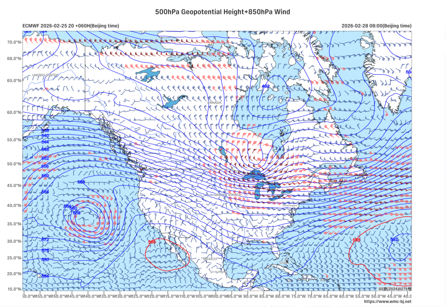
Figure 1 500 hPa Geopotential Height (units: dagpm) and 850 hPa Wind Field (units: m/s) at 08:00 (Beijing Time) on February 28, 2026
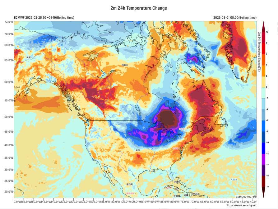
Figure 2 24-hour Temperature Change at 2 meters above ground level as of 08:00 (Beijing Time) on March 1, 2026 (Unit:℃)
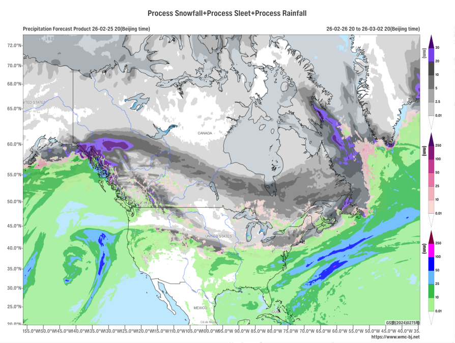
Figure 3 Accumulated Precipitation from 20:00 on February 26, 2026, to 20:00 on March 2, 2026 (Beijing Time) (Unit: mm)
https://www.wmc-bj.net
![]()
Author: Hu Yingying, Che Jinning Reviewer: Zhang Bo
English reviewer:Wang Yi Issue approver:Dai Kan