
Tropical Cyclone "Narelle" to Impact Northern Australia
At 14:00 Beijing Time on March 17, Tropical Cyclone "Narelle" formed near the waters of Australia. Following its formation, it moved in a west-southwest direction. By 08:00 Beijing Time on March 18, the cyclone reached its peak intensity with maximum sustained winds of 11 levels (equivalent to a Category 2 tropical cyclone) and a central pressure of 984 hPa.
Tropical Cyclone "Narelle" is expected to move westward at a speed of 15-20 km/h, gradually intensifying (Figure 1). As a result, over the next three days, northern Australia, Papua New Guinea, and the Solomon Islands will experience moderate to heavy rainfall, with localized heavy downpours or intense rain, accumulating 50-70 mm, and exceeding 250 mm in some areas (Figure 2). These regions will also be accompanied by winds of 4-6 on the Beaufort scale, with gusts reaching 8-9. Additionally, parts of Indonesia will see moderate to heavy rainfall, with localized heavy downpours or intense rain. Caution is advised against secondary disasters triggered by strong winds and heavy precipitation.
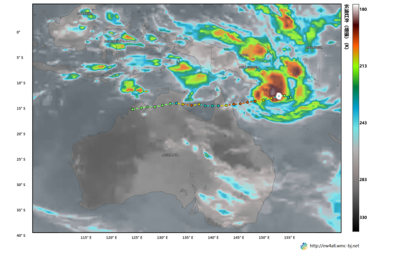
Figure 1: Satellite Cloud Image at 10:00 AM (Beijing Time) on March 18, 2026, and Track Forecast
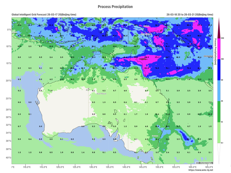
Figure 2: Accumulated Precipitation from 20:00 on March 18, 2026, to 20:00 on March 21, 2026 (Beijing Time), in millimeters (mm)
https://www.wmc-bj.net
![]()
Author: Che Jinning Reviewer: Guan Yue
English reviewer:Wang Yi Issue approver:Dai Kan