
A widespread cooling and severe rain-snow weather is expected in the eastern part of North America
Affected by the deepening and eastward movement of an upper-level trough (Figure 1), a significant temperature drop of 6-10°C, with localized decreases exceeding 14°C, is expected in southern Canada and most parts of the United States from March 10 to 12 (Figure 2). This will be accompanied by winds of 5-6 on the Beaufort scale, with gusts reaching 7-9. In parts of Ontario and Quebec, Canada, moderate to heavy snowfall is anticipated, with localized blizzard or severe blizzard conditions. Meanwhile, the central and eastern regions of the United States will experience moderate to heavy rainfall, with isolated heavy downpours. Accumulated precipitation in these areas is expected to range from 20-40 mm, with localized totals exceeding 50 mm (Figure 3). Attention should be given to the adverse impacts of the cooling and precipitation on transportation and travel.
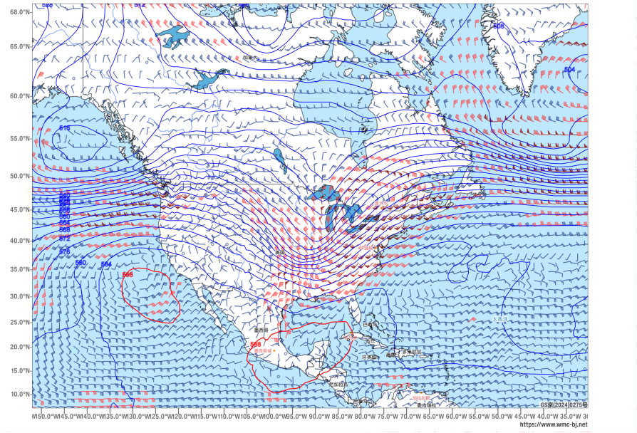
Figure 1: Forecast of 500 hPa Geopotential Height (contours, units: dagpm) and 850 hPa Wind Field (wind barbs, units: m/s) at 08:00 BJT on March 12, 2026
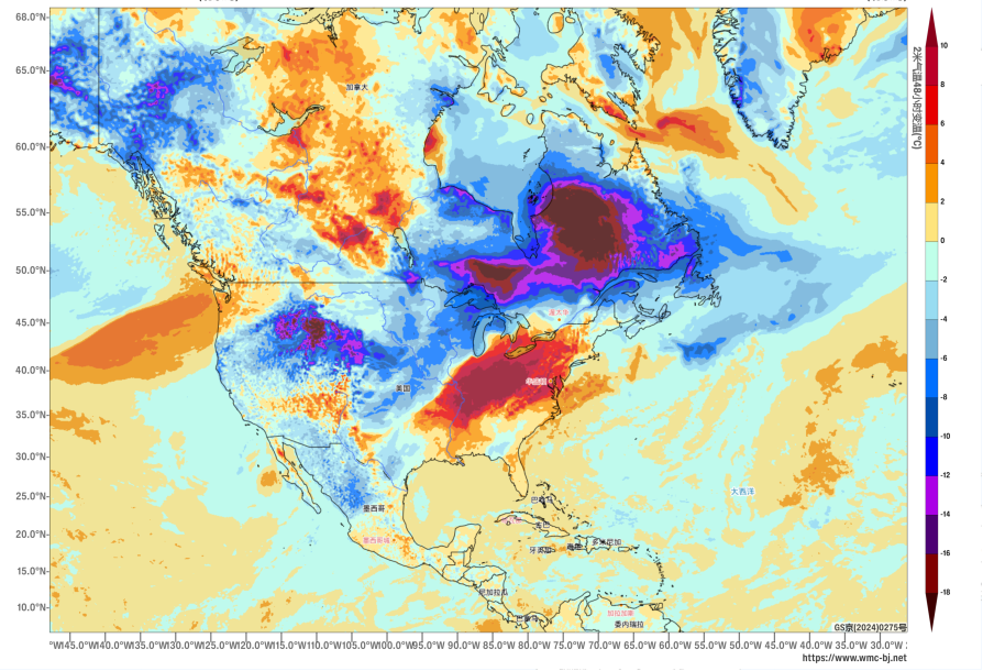
Figure 2: Forecast of 48-hour Temperature Change at 2 meters above ground level as of 20:00 (BJT) on March 11, 2026 (Shaded, Unit: °C)
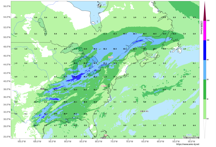
Figure 3: Accumulated Precipitation from 20:00 on March 10 to 20:00 on March 12, 2026 (BJT) (Unit: mm)
https://www.wmc-bj.net
![]()
Author: Kong Linghan Reviewer: Guan Yue
English reviewer:Dai Kan Issue approver:Wang Yi