



Bay of Bengal Storm "Akwan" to Impact Eastern India
Over the past 24 hours, Bay of Bengal storm "Asna" has continued to intensify. At 08:00 on the 18th, it was located over the central Bay of Bengal, approximately 720 km south-southeast of Kakinada in northeastern Andhra Pradesh, India. It is forecasted to move northwestward, then north-northwestward at a speed of 15-20 km per hour, with its intensity continuing to gradually increase. At its peak, it is expected to reach severe cyclonic storm strength (wind force 10-11, 25-30 m/s, equivalent to a severe tropical storm in China's classification). The storm is projected to make landfall along the coast of northeastern Andhra Pradesh, India, on the morning of the 20th (25-30 m/s, severe cyclonic storm, equivalent to a severe tropical storm in China's classification) (Figure 1).
Under its influence, from the 18th to the 20th, winds of force 6 to 8 with gusts up to force 9 to 10 are expected over the central and western Bay of Bengal, as well as along the coasts of central and northern Andhra Pradesh and Odisha, India. In some sea areas or specific regions, winds may reach force 9 to 11 with gusts of force 11 to 13 (Figure 2).
From the 19th to the 21st, regions including eastern India and Bangladesh will experience significant wind and rain. Specifically, parts of eastern India will see heavy to torrential rain, with localized intense downpours. Most areas can expect accumulated rainfall of 50-90 mm; meanwhile, Odisha and Andhra Pradesh in India, as well as the Khulna Division in Bangladesh, will receive 100-130 mm, with localized amounts exceeding 150 mm (Figure 3). Precautions should be taken against potential secondary disasters such as flash floods, landslides, and debris flows triggered by the heavy precipitation in the aforementioned regions. Additionally, attention is needed regarding the adverse impacts of strong winds on offshore operations, land-based infrastructure, and road traffic.
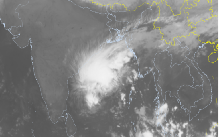
Figure 1 FY-2H Satellite Infrared Monitoring Image (08:00 Beijing Time, November 18, 2026)
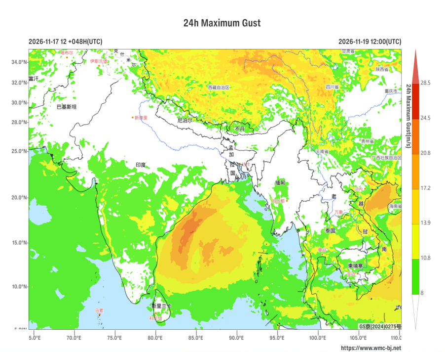
Figure 2 24-Hour Maximum Gust Forecast at 12:00 UTC on November 19, 2026 (Unit: m/s)
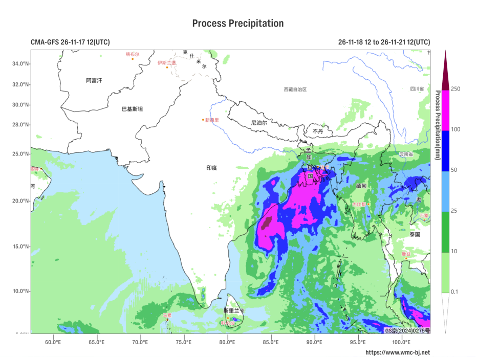
Figure 3: Forecast of Accumulated Precipitation from 12:00 UTC on November 18 to 12:00 UTC on November 21, 2026 (Unit: mm)
https://www.wmc-bj.net

Author: You Yuan Reviewer: Zhou Ningfang
English reviewer:Wang Yi Issue approver:Dai Kan