



The Ash Cloud from Krakatoa Volcano in Indonesia Will Continue to Drift Westward
According to FY-4B satellite monitoring, the Krakatoa volcano in Indonesia began to erupt around 01:00 BJT on September 5. Enhanced long-wave infrared imagery (Figure 1) and cloud-top height imagery (Figure 2) indicate that at 01:15 BJT on September 5, the minimum cloud-top brightness temperature of the volcanic ash cloud was approximately -60°C, with a cloud-top height of about 10-15 km. Following the eruption, the volcanic ash cloud spread westward, the cloud-top brightness temperature gradually increased, and the area with cloud-top heights exceeding 10 km expanded. FY-4B geostationary satellite true-color imagery shows that, as of 09:45 BJT, the volcano and its western region remained covered by a widespread volcanic ash cloud, with the coverage area expanding by approximately 2,900 square kilometers.
Over the next three days, no heavy rainfall events are expected around the Krakatoa volcano and its surrounding areas, resulting in no significant wet deposition removal conditions (Figure 3). At the upper levels (200-300 hPa), northeasterly flow prevails with wind speeds exceeding 20 m/s, providing stable steering flow (Figure 4); at the lower level (850 hPa), easterly winds will direct the volcanic ash to continue dispersing westward. In affected areas, localized visibility may decrease, and downwind coastal stretches and offshore shipping lanes could experience light suspended dust. Relevant authorities are advised to issue protective guidelines for outdoor operations and prepare for aviation route adjustments.
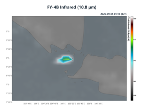
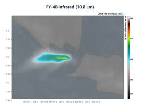
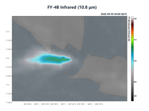
Figure 1. Enhanced Long-Wave Infrared Image from FY-4B Satellite
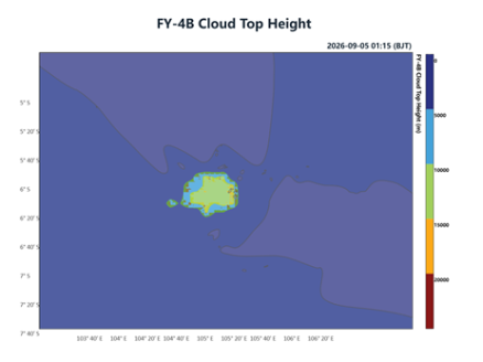
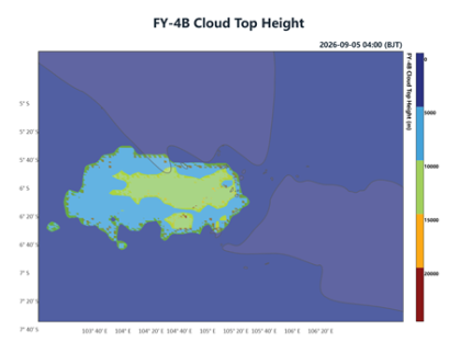
Figure 2. FY-4B Satellite Cloud Top Height Image
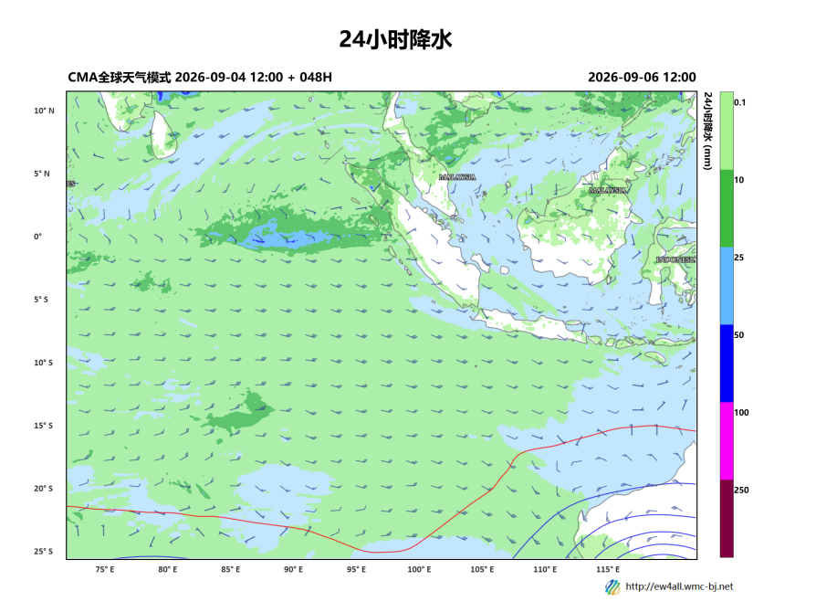
Figure 3: 24-hour precipitation forecast (shaded, units: mm), 500 hPa geopotential height (contours, units: dagpm), and 850 hPa wind field (barbs, units: m/s) at 20:00 BJT on September 6, 2026
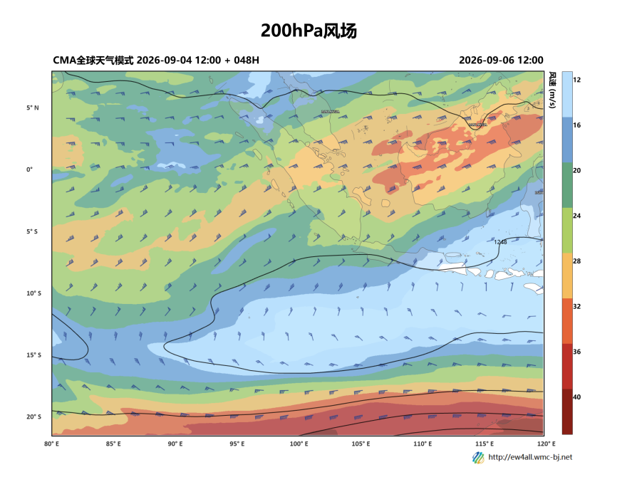
Figure 4: 200 hPa Wind Field Forecast at 20:00 BJT on September 6, 2026 (Unit: m/s)
https://www.wmc-bj.net

Author: Che Jinning, Zhang Yan Reviewer: Zhou Ningfang
English reviewer:Wang Yi Issue approver:Dai Kan