



Extremely Heavy Rainfall Expected in Parts of Central and Eastern Andhra Pradesh
Over the past 24 hours, "Murasu" intensified from a cyclonic storm into a very severe cyclonic storm. It made landfall along the coastal areas near Ongole, Andhra Pradesh, India, around 00:00, on November 3. Upon landfall, the maximum wind force near its center reached Level 12 (35 m/s, equivalent to a typhoon in China's classification).
Under its influence, on November 3, the coastal areas and eastern waters of Andhra Pradesh, India, will continue to experience winds of force 7 to 9, with localized winds reaching force 10 to 11 and gusts of force 12 to 13. From November 3 to the evening of November 4, "Murasu" will linger over Andhra Pradesh, bringing heavy rain to torrential rain in the central and eastern parts of the state, with some areas experiencing severe torrential rain or extremely severe torrential rain (400-600 mm). Additionally, southern Chhattisgarh, southern Odisha, and northeastern Tamil Nadu will see heavy rain to torrential rain (30-80 mm).
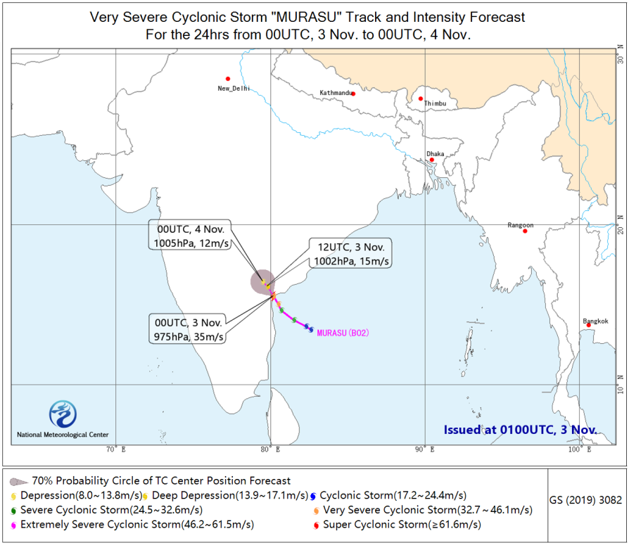
Figure 1: Forecast Track Trend of Extremely Severe Cyclonic Storm "Murasu" for the Next 24 Hours
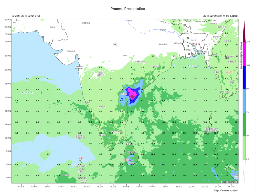
Figure 2: Precipitation Forecast from 12:00 on November 3, 2026, to 12:00 on the 5th
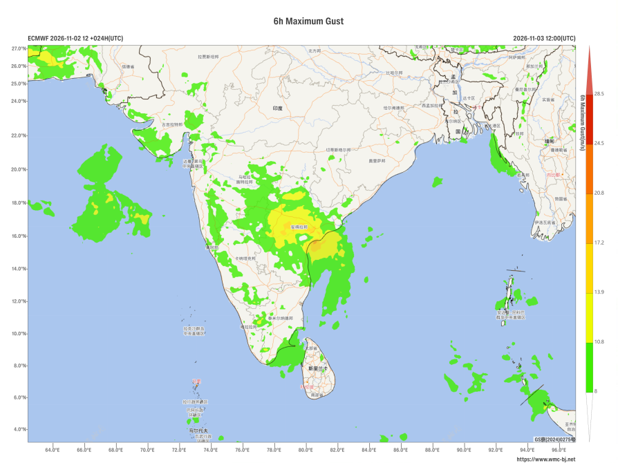
Figure 3: 6-Hour Maximum Gust Forecast for 12:00 on November 3, 2026

Author: He Lingli Reviewer: Liu Xiaobo
English reviewer:Wang Yi Issue approver:Dai Kan