



Typhoon Bavi Will Bring Strong Winds and Heavy Rain to the Philippine Islands
Typhoon Bavi will move westward before shifting to a northwest direction at a speed of 15-20 km/h, gradually approaching the northeastern coast of Taiwan Island. Its intensity will hold steady initially before starting to weaken on the 9th. Influenced by the typhoon and its outer circulation (Figure 1), heavy rain to torrential rain, with localized extremely heavy rain, will lash the Philippine Islands after the 9th. From the 9th to the 11th, the accumulated rainfall will reach 100-300 mm, locally exceeding 400 mm (Figure 2). Additionally, winds of force 5-6, with gusts of force 7-8, will sweep across the Philippines from south to north.
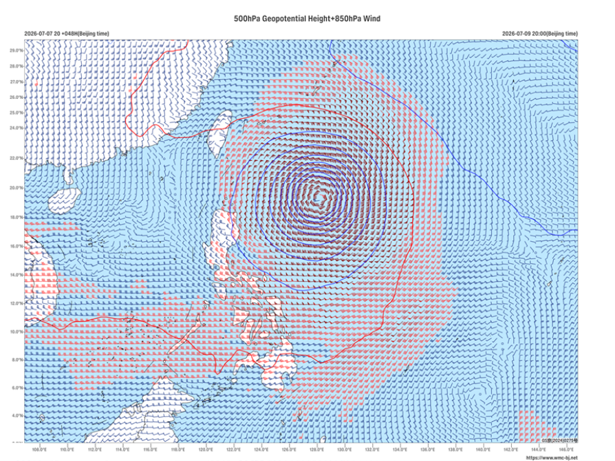
Figure 1 Forecast of 500 hPa Geopotential Height (contours, units: dagpm) and 850 hPa Wind Field (barbs, units: m/s) at 20:00on July 9, 2026 (BJT)
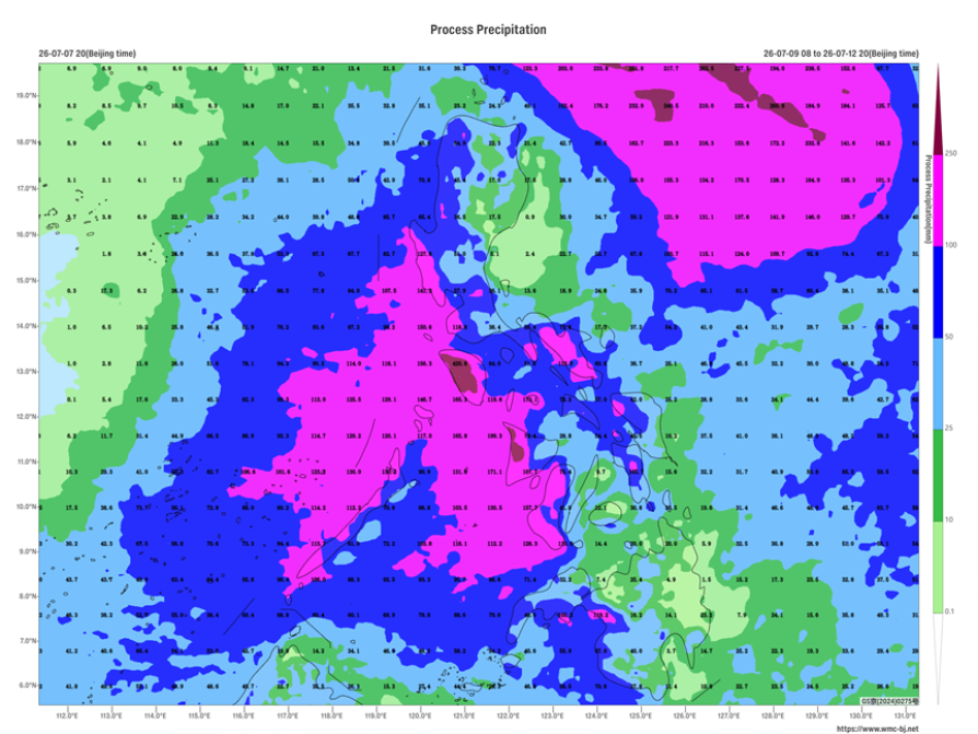
Figure 2 Forecast of Accumulated Precipitation from 08:00 on July 9 to 20:00 on July 12, 2026 (BJT) (Unit: mm)
https://www.wmc-bj.net

Author: Zhu Xiaowan Reviewer: Cai Xiangning
English reviewer:Wang Yi Issue approver:Dai Kan