
Most of North America is expected to experience strong winds, significant temperature drops, and severe rain and snowfall
Affected by an upper-level trough and warm, moist air currents at lower levels (Figure 1), it is expected that from March 14 to 17, regions including western Canada, Labrador Peninsula, northern United States, and the areas around the Great Lakes will experience moderate to heavy snow or sleet. Some areas will see severe to very severe snowstorms, with localized extreme blizzards, and cumulative precipitation ranging from 15 to 30 millimeters, with localized amounts exceeding 60 millimeters (Figure 2). Due to the influence of cold air, most of these regions will experience a temperature drop of 6 to 10°C from west to east, with localized decreases exceeding 14°C (Figure 3), accompanied by winds of 5 to 6 on the Beaufort scale and gusts reaching 8 to 9. Attention should be paid to the adverse impacts of gusty winds, temperature drops, rain and snow on transportation and travel.
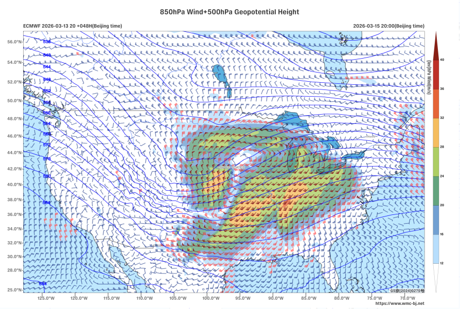
Figure 1: Forecast of 500 hPa Geopotential Height (contours, units: dagpm) and 850 hPa Wind Field (wind barbs, units: m/s) at 20:00 Beijing Time on March 15, 2026
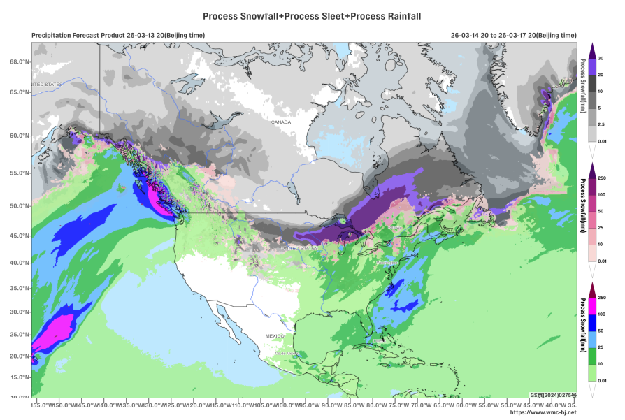
Figure 2: Accumulated Precipitation from 20:00 on March 14, 2026, to 20:00 on March 17, 2026 (Beijing Time) (Unit: mm)
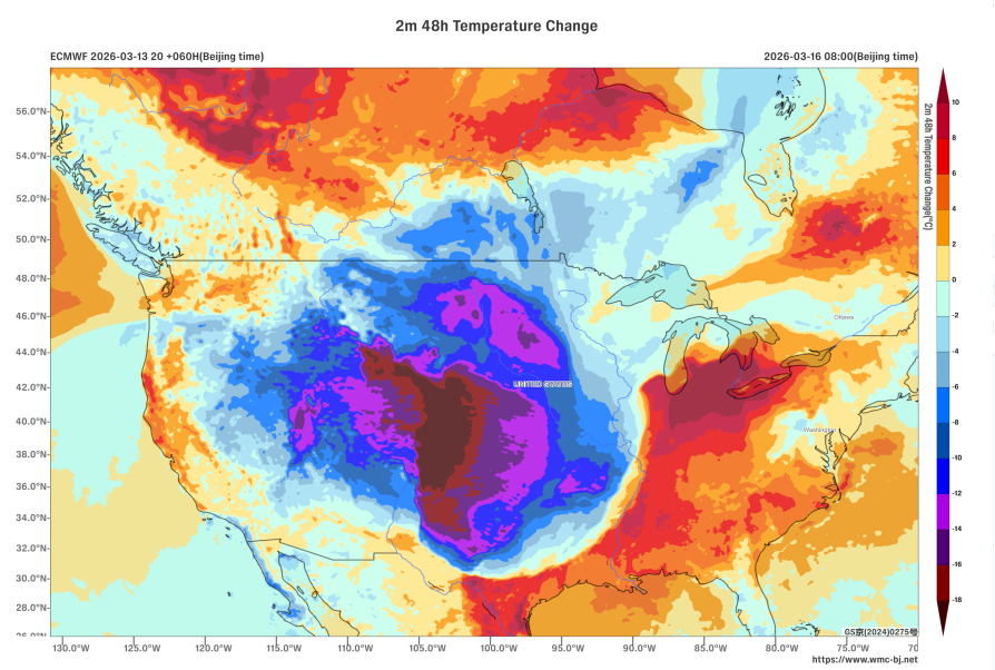
Figure 3: 48-hour Temperature Change Forecast at 2 meters above ground as of 08:00 (Beijing Time) on March 16, 2026 (Shaded, Unit: °C)
https://www.wmc-bj.net
![]()
Author: Che Jinning Reviewer: Guan Yue
English reviewer:Wang Yi Issue approver:Dai Kan