
Strong Precipitation Expected in Central and Northern Australia
Over the past week, parts of central-eastern Queensland, eastern New South Wales, and northern Western Australia experienced moderate to heavy rain, with localized downpours. In most of these areas, cumulative rainfall ranged from 60 to 100 millimeters, while the southeastern part of Queensland saw accumulations of 150 to 220 millimeters, with localized totals exceeding 300 millimeters (Figure 1). The most intense rainfall occurred from March 7 to 9, with southeastern Queensland experiencing heavy to very heavy rain, and some locations experiencing extreme downpours.
It is forecasted that from March 14 to 17, influenced by a low-vortex system (Figure 2), parts of the Northern Territory, northern Queensland, South Australia, and southern Victoria in Australia will continue to experience moderate to heavy rain, with localized heavy downpours or torrential rain. The cumulative precipitation is expected to range from 40 to 80 millimeters, with some areas exceeding 100 millimeters (Figure 3). Attention should be given to the potential secondary disasters caused by the rainfall, which may adversely affect transportation and travel.
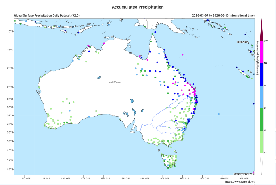
Figure 1: Accumulated Precipitation from March 7-13, 2026 (UTC) (Unit: mm)
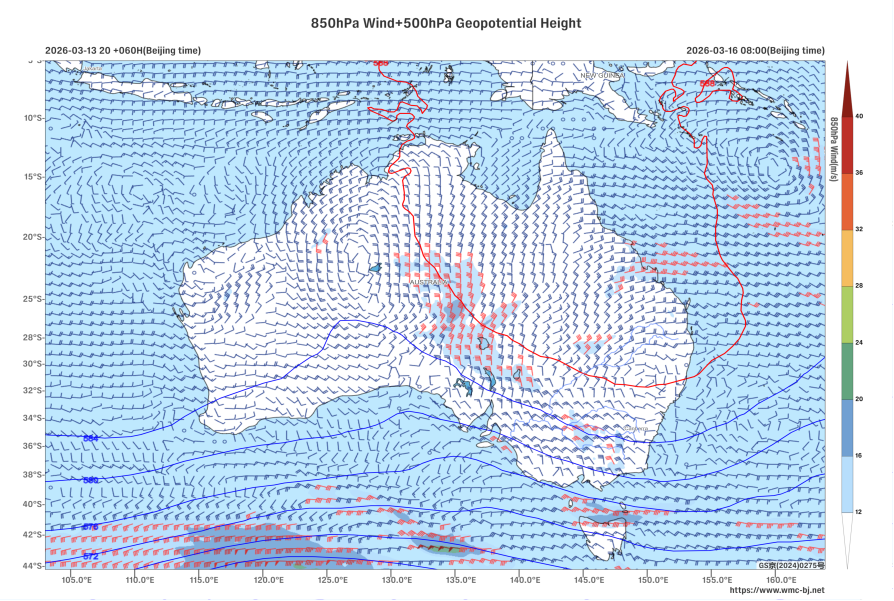
Figure 2: 500 hPa Geopotential Height (units: dagpm) and 850 hPa Wind Field (units: m/s) at 08:00 (Beijing Time) on March 16, 2026
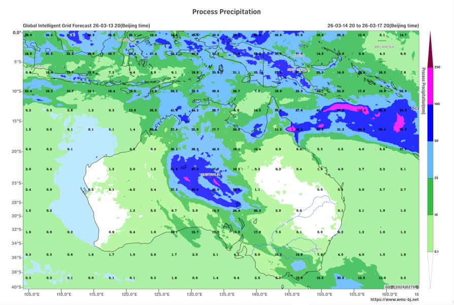
Figure 3: Accumulated Precipitation from 20:00 on March 14, 2026, to 20:00 on March 17, 2026 (Beijing Time) (Unit: mm)
https://www.wmc-bj.net
![]()
Author: Che Jinning Reviewer: Guan Yue
English reviewer:Wang Yi Issue approver:Dai Kan