
Widespread Rain, Snow and Cooling to Hit Europe
Affected by an upper-level trough (figure 1), it is expected that from February 13 to 16, 2026, parts of southern France, northern Spain, Italy, the western Balkan Peninsula and Türkiye will experience moderate to heavy rain, with torrential rain in isolated locations. The accumulated rainfall will range from 10~40 mm, and up to 50~60 mm locally.Parts of the western coastal areas of Northern Europe, most parts of Eastern Europe, Poland, Germany, the Alpine region and the Greater Caucasus region will see moderate to heavy snow or sleet, with blizzards or severe blizzards in some areas. The accumulated snowfall will be 5~15 mm, and up to 20~30 mm locally, exhibiting a certain degree of extremeness (figure 2).Most parts of Eastern Europe, southern Central Europe and the northern Balkan Peninsula will experience a temperature drop of 8~12℃, with a local temperature drop exceeding 14℃ (figure 3).Close attention should be paid to the adverse impacts of the rain, snow and temperature drop on local power facilities, transportation and other related industries.
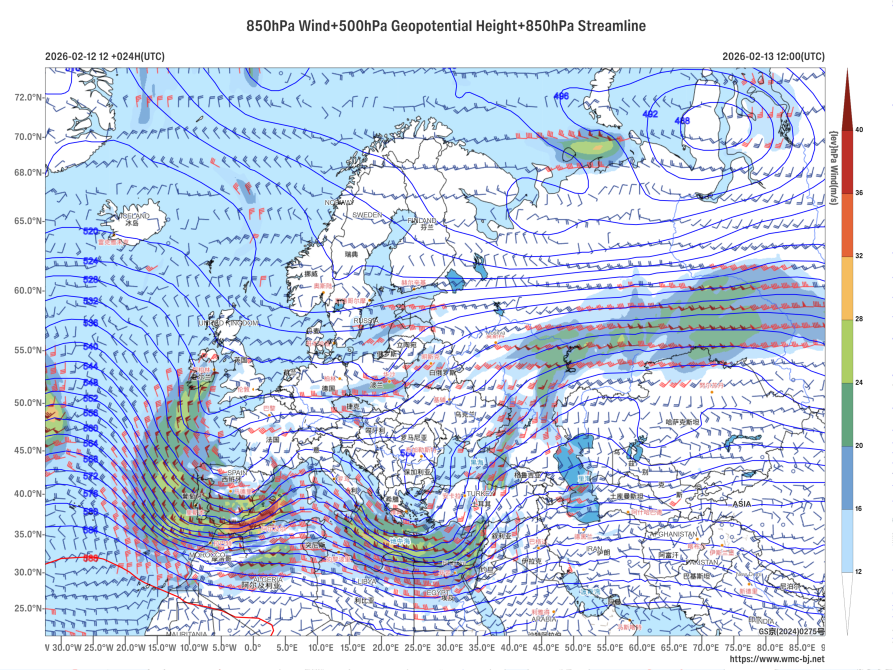
Figure 1: 500 hPa Geopotential Height (units: dagpm) and 850 hPa Wind Field (units: m/s) at 12:00 (UTC) on February 13, 2026.
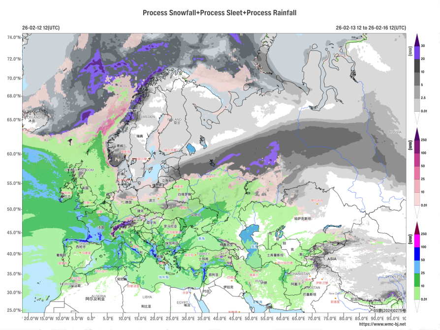
Figure 2: Accumulated Precipitation from 12:00 on February 13, 2026, to 12:00 on February 16, 2026 (UTC, units:mm).
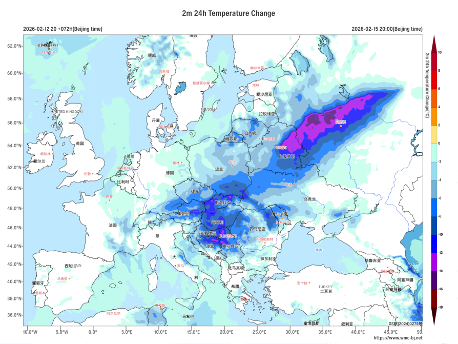
Figure 3: 24-hour Temperature Change at 2 meters (Unit: ℃) as of 12:00 (UTC) on February 15, 2026.
https://www.wmc-bj.net
![]()
Author: Xu Xianhuang Reviewer: Niu Ruoyun
English reviewer:Wang Yi Issue approver:Dai Kan