Severe Snowstorm Conditions along the U.S.-Canada Border
It is forecasted that from April 2 to 7, under the influence of an explosive cyclone (Figure 1), heavy to severe snowfall will occur in western and southern Canada, high-altitude areas of northwestern United States, and the northern-central regions of the United States. Specifically, parts of southern Quebec and southern Ontario in Canada, Newfoundland Island, southern North Dakota, and northern Minnesota in the United States will experience extreme to extraordinary severe snowfall. The cumulative snowfall in these areas is expected to range from 10 to 25 mm, with some regions receiving 30 to 50 mm (Figure 2). Additionally, these areas will be subjected to winds of 5 to 7 on the Beaufort scale, with gusts reaching 8 to 9, and gusts exceeding 10 on river, lake, and sea surfaces (Figure 3). Attention should be given to the adverse impacts of the blizzard conditions on transportation, energy supply, and other industries.
Additionally, moderate to heavy rain is expected in the central and eastern United States and the northeastern part of Mexico, with localized downpours. Some areas will experience severe convective weather, including short-duration intense rainfall and thunderstorms with strong winds. Tornadoes are possible in regions such as Texas, Oklahoma, and Missouri (Figure 4).
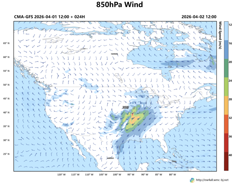
Figure 1. Forecast of 850 hPa Wind Field (wind barbs, unit: m/s) at 1200 UTC, April 2, 2026
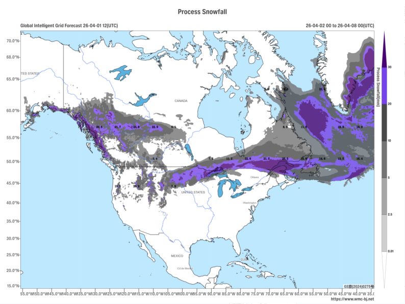
Figure 2. Forecast of Accumulated Snowfall from 00:00 on April 2 to 00:00 on April 8, 2026 (UTC), with shaded areas indicating heavy snowfall and above (Unit: mm)
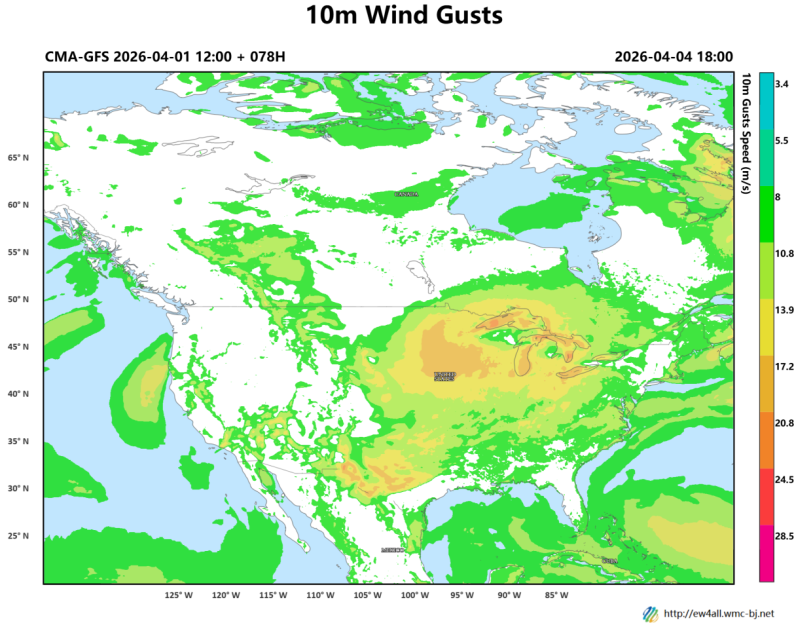
Figure 3. Forecast of Maximum Gust Wind Speed from 1800 UTC on April 3, 2026, to 1800 UTC on April 4, 2026 (Shaded areas indicate winds exceeding Beaufort Force 4, units: m/s)
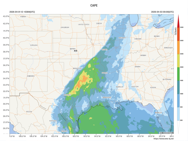
Figure 4. Forecast of Convective Available Potential Energy (shaded, units: J/kg) at 00:00 UTC on April 3, 2026
https://www.wmc-bj.net
![]()
Author: Huo Da Reviewer: Zhou Ningfang
English reviewer:Wang Yi Issue approver:Dai Kan