Rainfall in Afghanistan and Pakistan is Expected to Continue
According to global exchange station monitoring and information from Afghanistan's National Disaster Management Department, since March 25, moderate to heavy rain has been observed in Afghanistan and the central-northern regions of Pakistan, with torrential or extremely heavy rain in northeastern Pakistan. In high-altitude areas, heavy snow or sleet has been reported (Figure 1). Due to the persistent above-normal precipitation in the preceding period, the intense rainfall on the 25th triggered secondary disasters such as flash floods and landslides.
It is forecasted that from April 2 to 5, under the combined influence of an upper-level trough, a low-level warm and moist jet stream, and orographic lifting (Figure 2), moderate to heavy rain will continue in central and eastern Afghanistan and Pakistan. Eastern Afghanistan and western Pakistan are expected to experience torrential rain, while high-altitude mountainous areas will see heavy snow or rain-snow mix. The cumulative precipitation for this period is anticipated to be 20-50 mm, with some areas receiving 60-90 mm (Figure 3). Continuous attention is required for the adverse impacts of localized heavy rainfall, such as flash floods and landslides.
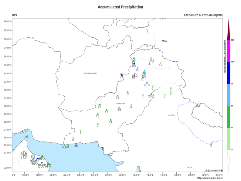
Figure 1. Accumulated Precipitation from March 25 to April 1, 2026 (UTC) - Observed Data (Station-Based, Units: mm)
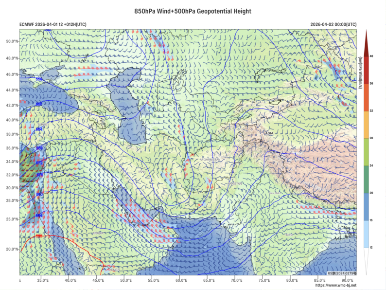
Figure 2. Forecast of 500 hPa Geopotential Height (contours, units: dagpm) and 850 hPa Wind Field (wind barbs, units: m/s) at 00:00 UTC, April 2, 2026
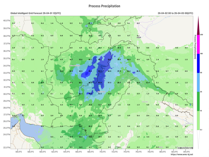
Figure 3. Forecasted Accumulated Precipitation from 0000 UTC April 2 to 0000 UTC April 5, 2026 (Shaded, Units: mm)
https://www.wmc-bj.net
![]()
Author: Huo Da Reviewer: Zhou Ningfang
English reviewer:Wang Yi Issue approver:Dai Kan