
"FYTIA" to Bring Severe Wind and Rain to Madagascar
Typhoon Fytia made landfall near the coast of Mahajanga Province in northwestern Madagascar on the morning of January 31, 2026, with maximum sustained winds of 13 levels (Figure 1). It is expected to move southeastward at a speed of 5-10 kilometers per hour, gradually weakening in intensity, and will re-enter the sea on February 1, continuing its movement towards the southeast.
It is forecasted that from January 31 to February 3, 2026, due to its influence, northern and southeastern Madagascar, southeastern Tanzania, northeastern Mozambique, Malawi, and the Comoros will experience moderate to heavy rainfall, with some areas likely to see torrential to extremely heavy downpours. The cumulative precipitation in these regions is expected to range from 30 to 90 mm, with some areas receiving 120 to 200 mm(Figure 2). This will be accompanied by severe convective weather, including short-duration intense rain and thunderstorms with strong winds. The coastal areas of northwestern Madagascar will face winds of 9 to 10 on the Beaufort scale, with gusts reaching 11 to 13 (Figure 3). Precautions are necessary to mitigate potential secondary disasters such as flooding, landslides, mudslides, and urban waterlogging, as well as adverse impacts on power facilities, transportation, and other sectors in the affected regions.
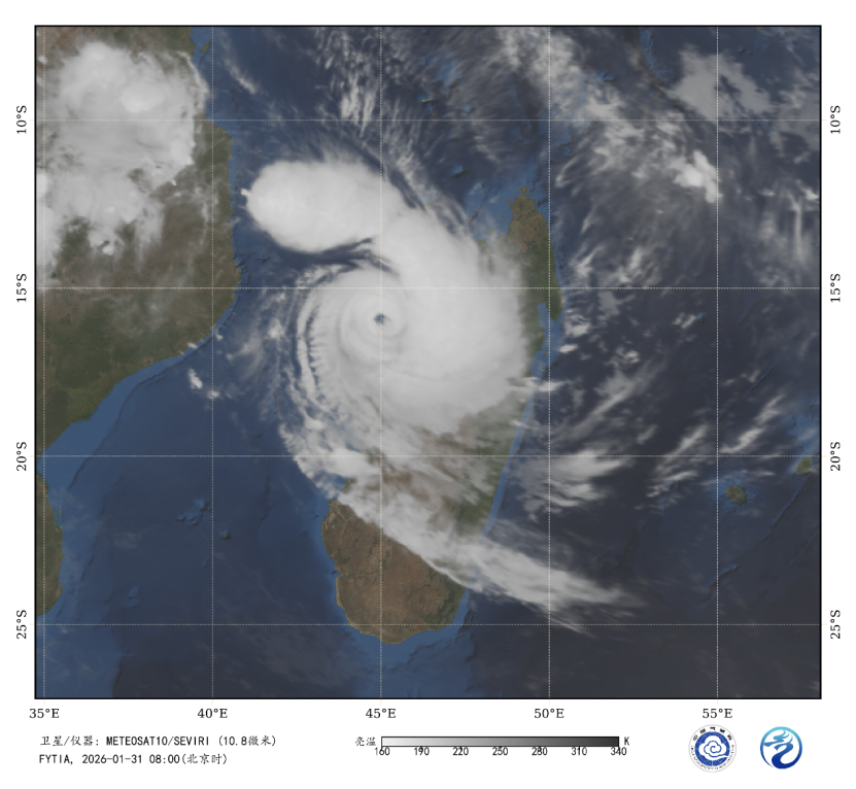
Figure 1 Satellite Infrared Monitoring Image at 08:00 (BJT) on January 31, 2026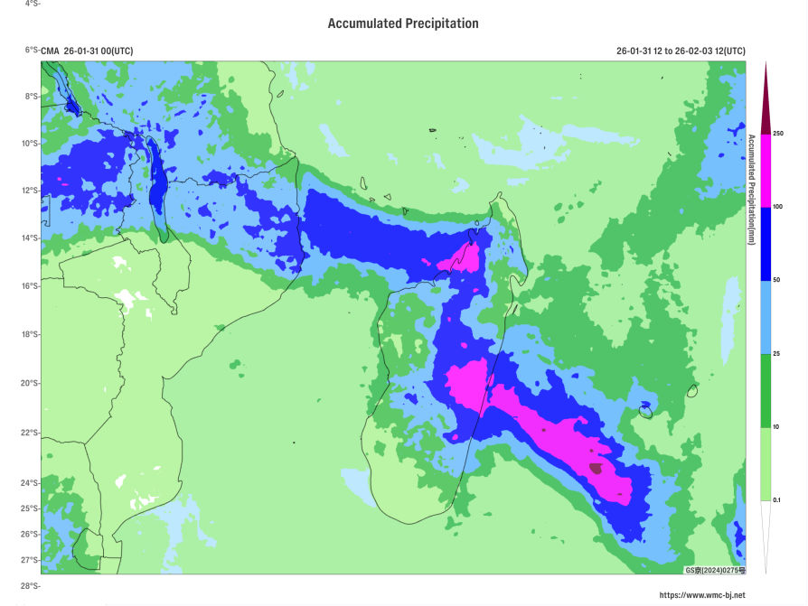
Figure 2: Forecast of Accumulated Precipitation from 00:00 on January 31 to 12:00 on February 3, 2026 (UTC, unit:mm)
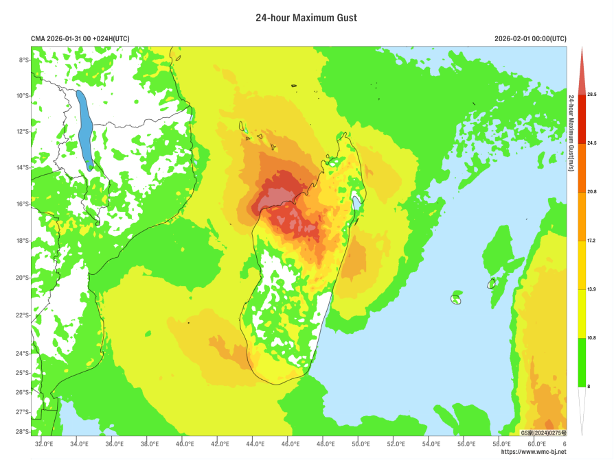
Maximum Gust Forecast Map from 00:00 on January 31, 2026, to 00:00 on February 1, 2026 (UTC) (Shaded, Unit: m/s)
https://www.wmc-bj.net
![]()
Author: Zhang Suzhao, Zhong Huizi Reviewer: Zhang Bo
English reviewer:Wang Yi Issue approver:Dai Kan