The Philippine Islands are Expected to Experience Severe Wind and Rainfall
Over the next three days, influenced by a tropical disturbance system (Figure 1), parts of central and southern Philippines are expected to experience moderate to heavy rainfall. Specifically, the Eastern Visayas, Central Visayas, northern Caraga Region, and Northern Mindanao will see torrential or extreme rain, with cumulative rainfall totals ranging from 60 to 90 millimeters. Some areas may receive 120 to 150 millimeters, and localized regions could exceed 200 millimeters (Figure 2). Most of these areas will also be accompanied by winds of 5 to 6 on the Beaufort scale, with gusts reaching 9 to 10 in coastal regions (Figure 3). Attention should be given to the potential secondary disasters caused by the heavy rainfall, such as flash floods, geological hazards, and urban flooding, as well as the adverse impacts on transportation and other industries.
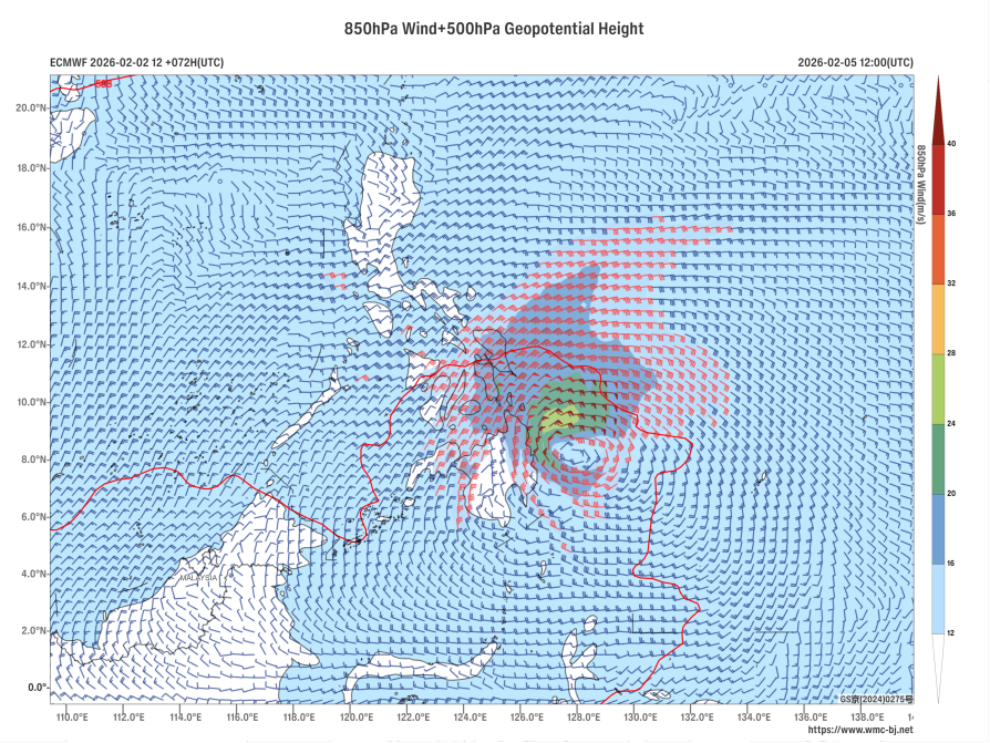
Figure 1 Forecast of 500 hPa Geopotential Height (units: dagpm) and 850 hPa Wind Field at 12:00 UTC on February 5, 2026 (units: m/s)
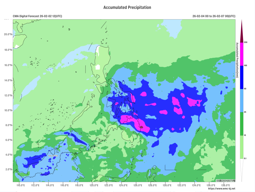
Figure 2 Forecasted Accumulated Precipitation from February 4 to 6, 12:00 UTC (Shaded, Unit: mm)
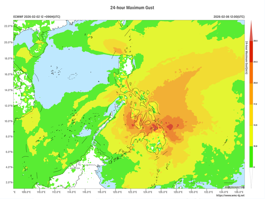
Figure 3 Maximum Gust Wind Speed for 24 Hours at 12:00 UTC on February 6, 2026 (Shaded, Unit: m/s)
https://www.wmc-bj.net
![]()
Author: Hu Yingying Reviewer: Niu Ruoyun
English reviewer:Wang Yi Issue approver:Dai Kan