



Bagmati Province in Nepal Continues to Experience Frequent Rainfall
Over the past 10 days, Nepal has experienced persistent rainfall, with accumulated precipitation reaching heavy rain to intense rain levels (Figure 1). Over the next three days, the central and eastern parts of Nepal will be influenced by the peripheral circulation of a monsoon depression over northern India (Figure 2). Bagmati Province can expect frequent rain, and due to orographic lift along the southern foothills of the Himalayas, localized heavy rain or intense downpours will occur, with the heavy rainfall areas being relatively scattered (Figure 3). Notably, the rainfall intensity will be relatively stronger on the 29th. Precautions are needed to guard against potential secondary disasters such as flash floods, landslides, and debris flows triggered by the persistent heavy precipitation.
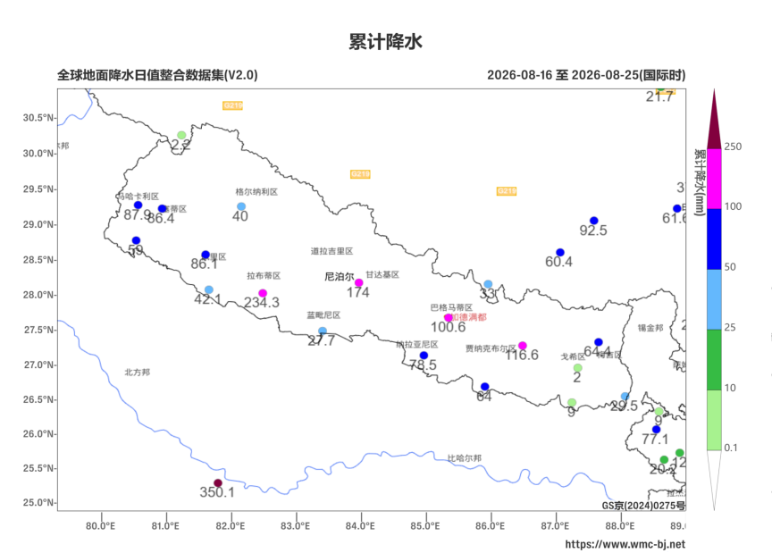
Figure 1. Real-time observation of accumulated station rainfall from August 16 to 25, 2026 (UTC)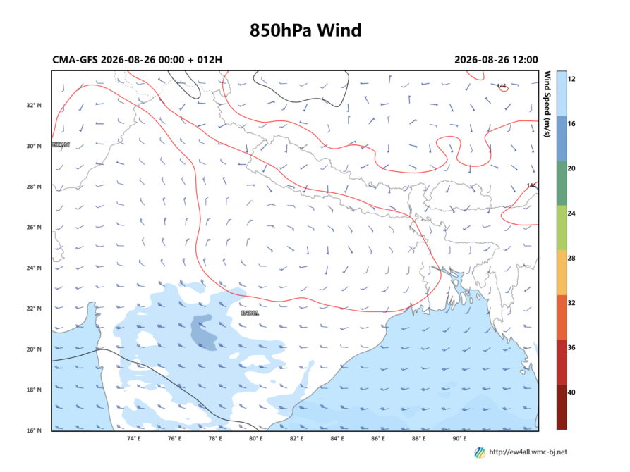
Figure 2. Forecast of 850 hPa Geopotential Height (contours, units: dagpm) and 850 hPa Wind Field (barbs, units: m/s) at 12:00 UTC on August 26, 2026
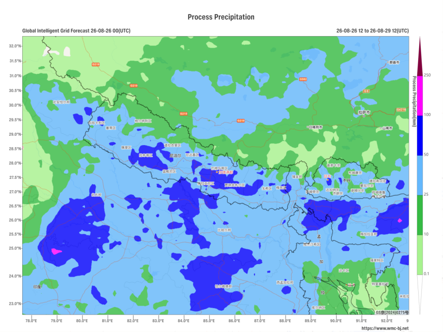
Figure 3. Forecast of Accumulated Precipitation from 12:00 UTC on August 26, 2026 to 12:00 UTC on the 29th (Unit: mm)
https://www.wmc-bj.net

Author: Huo Da Reviewer: Bao Yuanyuan
English reviewer:Wang Yi Issue approver:Dai Kan