



Strong Cold Air Activity in Central and Southern South America
Recently, Antarctic cold air has spread northward, forming a low-pressure vortex and trough over the southeastern Pacific (Figure 1). Over the next 5 days, the combined effects of strong cold air ahead of the trough and the warm, moist airflow carried by the westerlies, along with orographic lift from the Andes Mountains, will bring frequent precipitation to central Chile. Some areas can expect heavy to intense rain (Figure 2), while high-altitude mountainous regions will see heavy to intense snow, with localized severe snowstorms. Additionally, under the influence of the strong cold air, central-southern, northern, and southeastern Argentina, Uruguay, and southern Paraguay will experience significant winds and temperature drops. Most areas will see temperatures fall by 6-8℃, with some areas experiencing drops exceeding 10℃, accompanied by force 5-6 winds and gusts of force 7-8. Attention should be paid to the adverse impacts of localized heavy downpours, snowfall, and freezing temperatures on sectors such as transportation, agriculture, and energy.
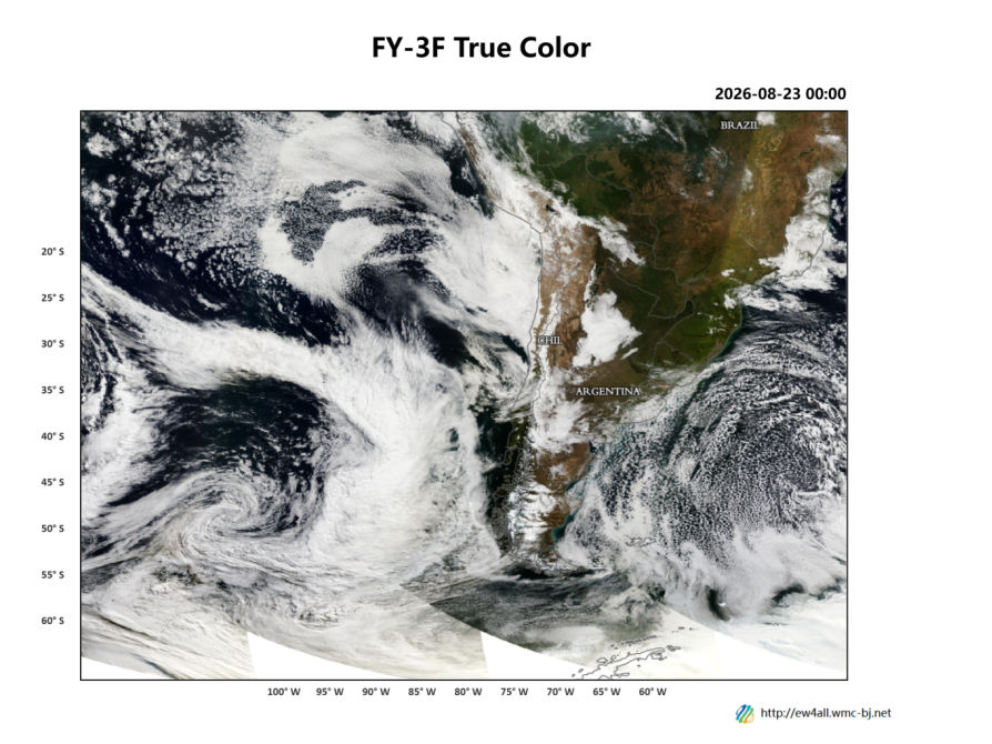
Figure 1: FY-3F Cloud Imagery at 00:00 UTC on August 23, 2026
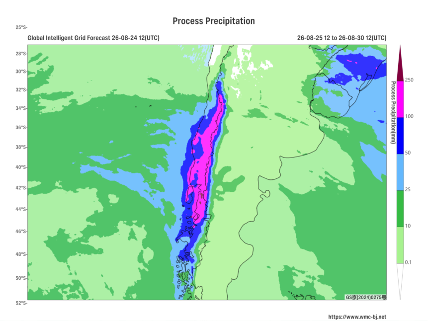
Figure 2: Forecast of Accumulated Precipitation from 12:00 on August 25 to 12:00 on August 30, 2026 (UTC) (Unit: mm)
https://www.wmc-bj.net

Author: You Yuan Reviewer: Zhou Ningfang
English reviewer:Wang Yi Issue approver:Dai Kan