



Heavy Rainfall in Southeast Australia and New Zealand
Jointly influenced by the eastward movement of a westerly trough and a low vortex (Figure 1), it is expected that over the next five days, parts of southeastern Australia, Tasmania, and New Zealand will experience frequent moderate to heavy rain, with localized heavy rainstorms or intense downpours, accompanied by force 4 to 6 winds and coastal gusts reaching force 7 to 8. The accumulated precipitation in the aforementioned areas will range from 50 to 150 mm, with localized areas exceeding 250 mm (Figure 2). Precautions should be taken against secondary disasters such as flash floods and mudslides that may be triggered by the heavy rainfall.
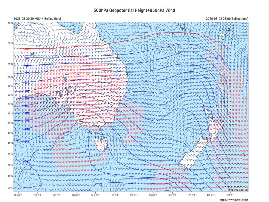
Figure 1: Forecast of 500 hPa Geopotential Height (contours, units: dagpm) and 850 hPa Wind Field (barbs, units: m/s) at 08:00 BJT, June 2, 2026
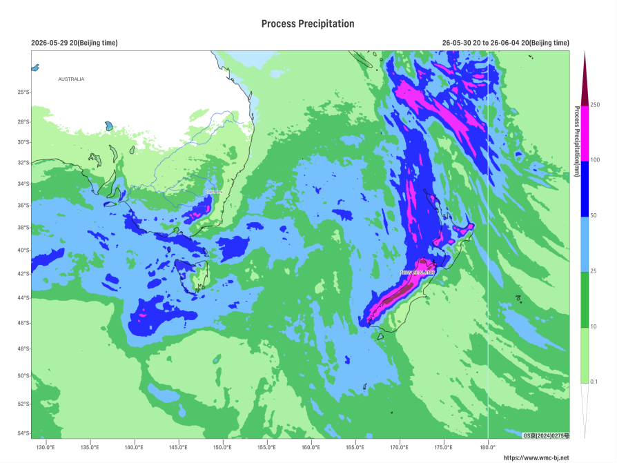
Figure 2: Forecast of Accumulated Precipitation from 20:00 on May 30 to 20:00 on June 4, 2026 (Beijing Time) (Shaded, in mm)
https://www.wmc-bj.net

Author: Zhu Qingliang Reviewer: Ma Jie
English reviewer:Wang Yi Issue approver:Dai Kan