Heavy Rainfall in Central and Southern Japan and the Ryukyu Islands
Influenced by the eastward movement of the Jianghuai cyclone (Figure 1), over the next three days, parts of central and southern Japan and the Ryukyu Islands will experience moderate to heavy rain, with isolated heavy rainstorms or intense downpours in localized areas. These conditions will be accompanied by severe convective weather such as short-term intense rainfall and thunderstorm gales, while coastal gusts could reach force 7 to 9. The accumulated precipitation in the aforementioned areas is expected to range from 50 to 150 mm, with localized areas exceeding 250 mm (Figure 2). Precautions should be taken against potential secondary disasters triggered by the heavy rainfall, including flash floods, landslides, debris flows, and urban waterlogging.
Later, around the 27th, influenced by the eastward and northward movement of Typhoon Mekkhala, the aforementioned regions will again experience widespread wind and rain.
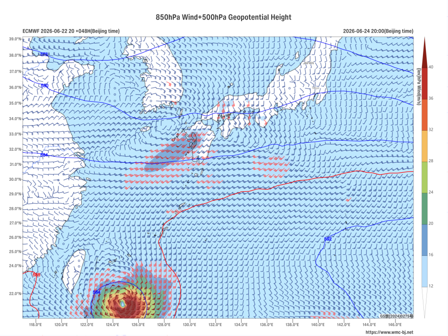
Figure 1: Forecast of 500 hPa Geopotential Height (contours, units: dagpm) and 850 hPa Wind Field (barbs, units: m/s) at 20:00 BJT on June 24, 2026
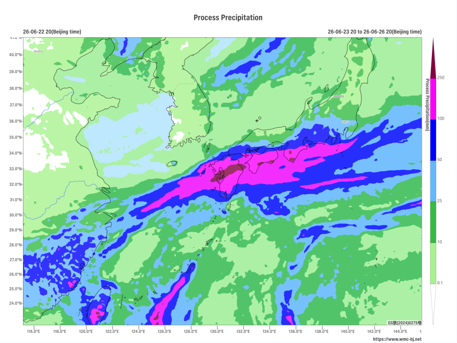
Figure 2: Forecast of Accumulated Precipitation from 20:00 BJT on June 23 to 20:00 BJT on June 26, 2026 (Shaded, mm)
https://www.wmc-bj.net
![]()
Author: Zhu Qingliang Reviewer: Cai Xiangning
English reviewer:Wang Yi Issue approver:Dai Kai