



Typhoon Bavi to Impact Central and Northern Korean Peninsula
Typhoon Bavi is expected to move northeastward at a speed of 10-15 km/h, gradually weakening in intensity. It will move into the northern waters of the Yellow Sea during the day on the 14th, and gradually transition into an extratropical cyclone after the 15th (Figure 1). Influenced jointly by Typhoon Bavi and the subtropical high belt (Figure 2), moderate to heavy rain will hit the central and northern parts of the Korean Peninsula from the night of the 13th to the 16th, with isolated heavy rain or intense downpours in northwestern Korea. During this period, accumulated rainfall in the central and northern Korean Peninsula will reach 40-70 mm, while northwestern Korea will see 90-120 mm, and localized areas in North Pyongan Province and Bujin will experience over 150 mm (Figure 3). Rainfall over the Korean Peninsula will intensify significantly starting on the night of the 13th, with the peak heavy rain period occurring on the 14th, before gradually weakening from the 15th onwards. Additionally, winds of force 6 to 7, with gusts of force 9 to 10, are expected in the western Korean Peninsula and its adjacent waters.
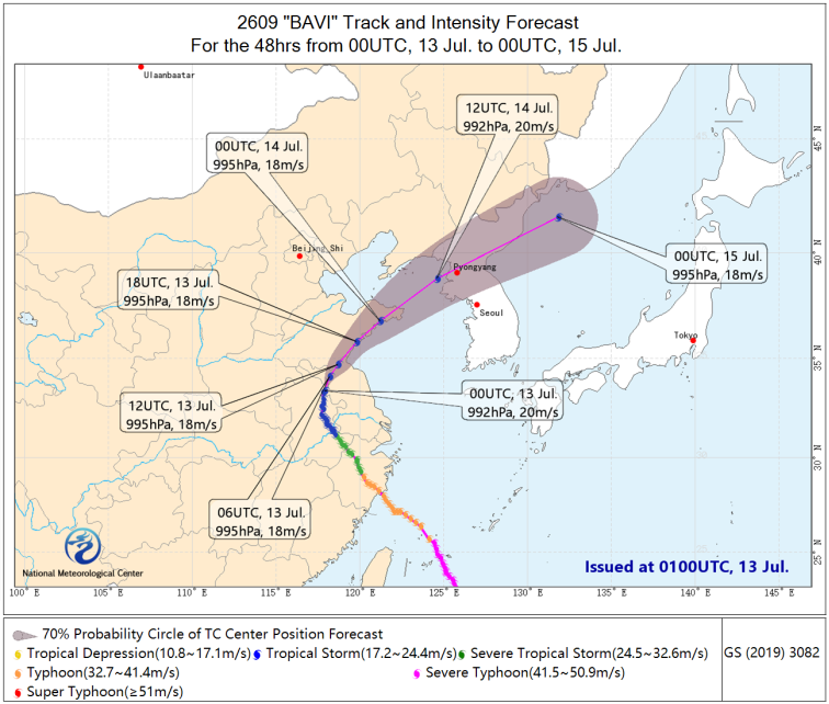
Figure 1: Probability Forecast Track for Typhoon Bavi over the Next 48 Hours
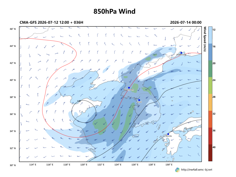
Figure 2: Forecast of 500 hPa Geopotential Height (contours, units: dagpm) and Wind Field (barbs, units: m/s) at 00:00 UTC on July 14, 2026
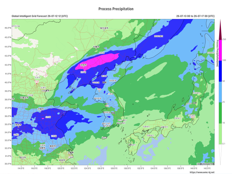
Figure 3: Forecast of Accumulated Precipitation from 00:00 UTC on July 13 to 00:00 UTC on July 17, 2026 (Unit: mm)
https://www.wmc-bj.net

Author: Che Jinning Reviewer: Zhang Bo
English reviewer:Wang Yi Issue approver:Dai Kan