



Eastern US and Mexico Experience Severe Winds and Heavy Rain
From October 9 to 12, under the influence of a tropical cyclone (Figure 1), heavy to torrential rain is expected in the eastern United States, as well as the western and central-southern parts of Mexico, with severe torrential rain in some areas and isolated extreme torrential downpours along the central coast of Mexico. Across most of these regions, accumulated rainfall will range from 40 to 70 mm. However, parts of central-southern Mexico and the southeastern United States will see 100 to 200 mm, with localized totals along the central coast of Mexico exceeding 280 mm (Figure 2). Additionally, winds of force 6 to 9 are anticipated, strengthening to force 10 to 13 in coastal areas with gusts of force 14 to 16. Over the nearshore waters off the central-western coast of Mexico, wind forces will reach 14 to 17, with gusts exceeding force 17 (Figure 3). Precautions should be taken against potential secondary disasters triggered by the intense precipitation, such as flash floods, landslides, and debris flows, as well as the adverse impacts of strong winds on offshore operations, land-based infrastructure, and road traffic.
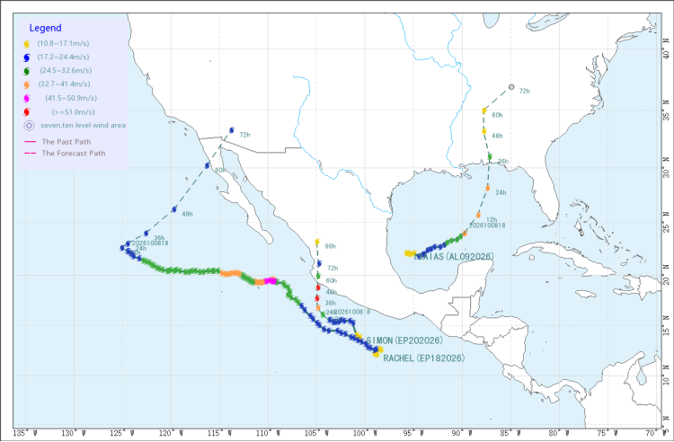
Figure 1: Tropical Cyclone Track Forecast from 18:00 UTC on October 8, 2026 to 18:00 UTC on October 12, 2026
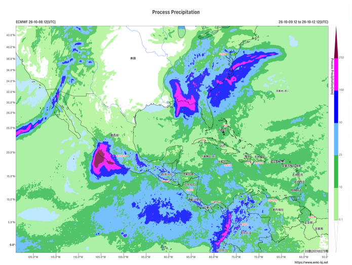
Figure 2: Forecast of Accumulated Precipitation from 12:00 UTC on October 9, 2026 to 12:00 UTC on the 12th (Unit: mm)
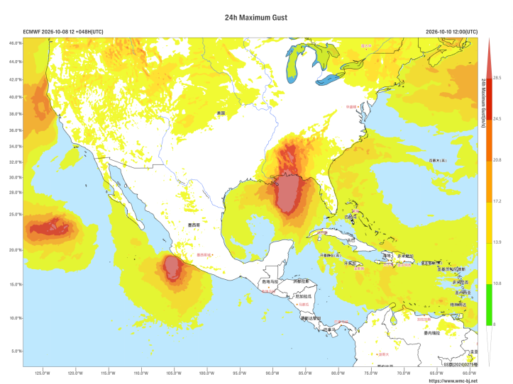
Figure 3: 24-Hour Maximum Gust Chart at 12:00 UTC on October 10, 2026 (Unit: m/s)
https://www.wmc-bj.net

Author: Zhai Yingjia Reviewer: Liu Xiaobo
English reviewer:Wang Yi Issue approver:Dai Kan