



Continued Heavy Rainfall in India and Myanmar
Frequent Rainfall in Southern DPRK and South Korea
Affected by a tropical disturbance (Figure 1), over the next week, parts of central and eastern India, the west coast of India, Nepal, Bhutan, Bangladesh, Myanmar, northern Indochina Peninsula, the Philippines, and other areas will see heavy to torrential rain, with locally very heavy to extremely heavy rainfall, accompanied by severe convective weather such as short-term heavy precipitation and thunderstorm gales. The main heavy rainfall periods will be from the 18th to the 21st and from the 23rd to the 24th (July). The accumulated rainfall will generally be 100–180 mm, with locally over 250 mm, and locally exceeding 400 mm in parts of Myanmar and eastern India (Figure 2). Attention should be paid to guarding against secondary disasters such as flash floods, landslides, and mudslides that may be triggered by persistent precipitation.
Over the next week, under the influence of a low vortex shear, southern DPRK and South Korea will experience frequent rainfall. In particular, a relatively intense rainfall process will occur from the 18th to the 21st, bringing heavy to torrential rain to most areas and locally very heavy rain. The accumulated rainfall will range from 60 to 120 mm, with locally over 180 mm (Figure 2).
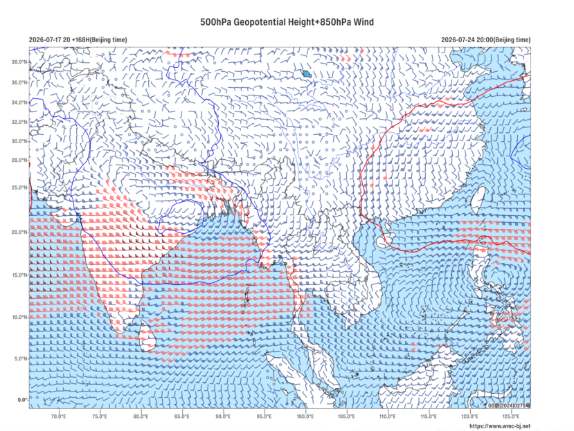
Figure 1 Forecast of 500 hPa Geopotential Height (contours, units: dagpm) and 850 hPa Wind Field (barbs, units: m/s) at 20:00 BJT on July 24, 2026
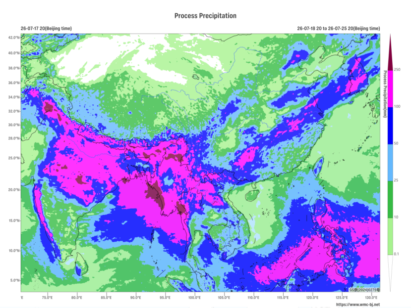
Figure 2 Forecast of Accumulated Precipitation from 20:00 BJT on July 18 to 20:00 BJT on July 25, 2026 (Unit: mm)
https://www.wmc-bj.net

Author: Zhu Xiaowan Reviewer: Liu Xiaobo
English reviewer:Wang Yi Issue approver:Dai Kan