Afghanistan and Pakistan to Experience a New Round of Precipitation
It is forecasted that from April 17 to 20, influenced by a mid-latitude upper-level trough (Figure 1), eastern Afghanistan, northern Pakistan, and southern Tajikistan will experience a rainfall event. Some areas will see moderate to heavy rain, accompanied by severe convective weather such as thunderstorms, strong winds, and short-duration intense rainfall. High-altitude mountainous regions are expected to receive heavy to severe snowfall or sleet. The cumulative precipitation for this period is anticipated to be 15-25 mm in these regions, with some areas receiving 30-50 mm and locally exceeding 80 mm (Figure 2). These regions have already experienced significantly above-average precipitation earlier, which increases the risk of secondary disasters such as flash floods and landslides. Attention should be given to the adverse impacts of this event, and appropriate preventive measures should be taken.
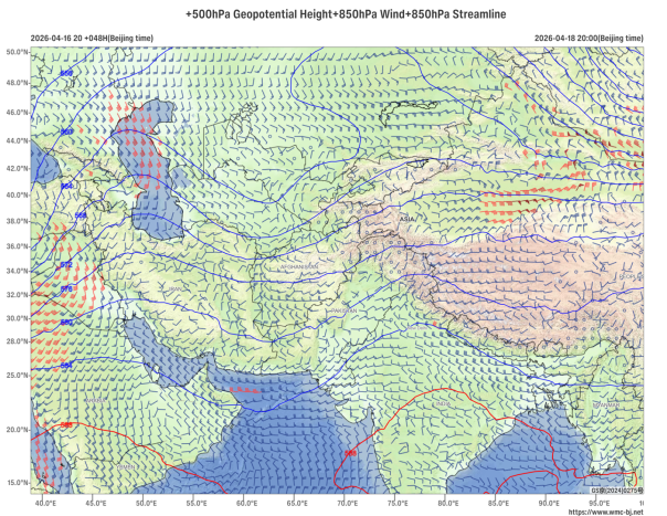
Figure 1: Forecast of 500 hPa Geopotential Height (contours, units: dagpm) and 850 hPa Wind Field (wind barbs, units: m/s) at 20:00 BST on April 18, 2026
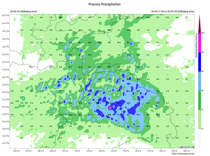
Figure 2: Forecast of Accumulated Precipitation from 20:00 on April 17 to 20:00 on April 20, 2026 (Beijing Time) (Shaded, Unit: mm)
https://www.wmc-bj.net
![]()
Author: Bao Huimeng Reviewer: Zhou Ningfang
English reviewer:Wang Yi Issue approver:Dai Kan