



France, Spain, and Other Countries to Experience Severe Convective Weather
Over the next 3 days, the polar high over Northern Europe and the subtropical high over North Africa will remain stable, while the Atlantic cyclone moves slowly toward Western Europe. All three systems are significantly stronger than usual (Figure 1). The Atlantic cyclone carries warm, moist air, which converges intensely with the hot, dry air on the northwestern flank of the North Africa high. This triggers significant dynamic lifting along the edge of the otherwise stable subtropical high. Coupled with favorable moisture and thermal conditions, this setup promotes severe convective weather—such as thunderstorm gales and short-duration heavy rainfall—across central and northern Portugal, northern Spain, most of France, and northern Italy. Additionally, showers or thunderstorms are expected in the UK, the Netherlands, and Switzerland (Figure 2).
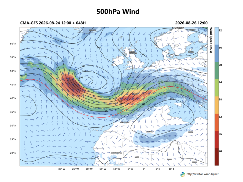
Figure 1: Forecast of 500 hPa Geopotential Height (contours, units: dagpm) and 500 hPa Wind Field (barbs, units: m/s) at 12:00 UTC on August 26, 2026
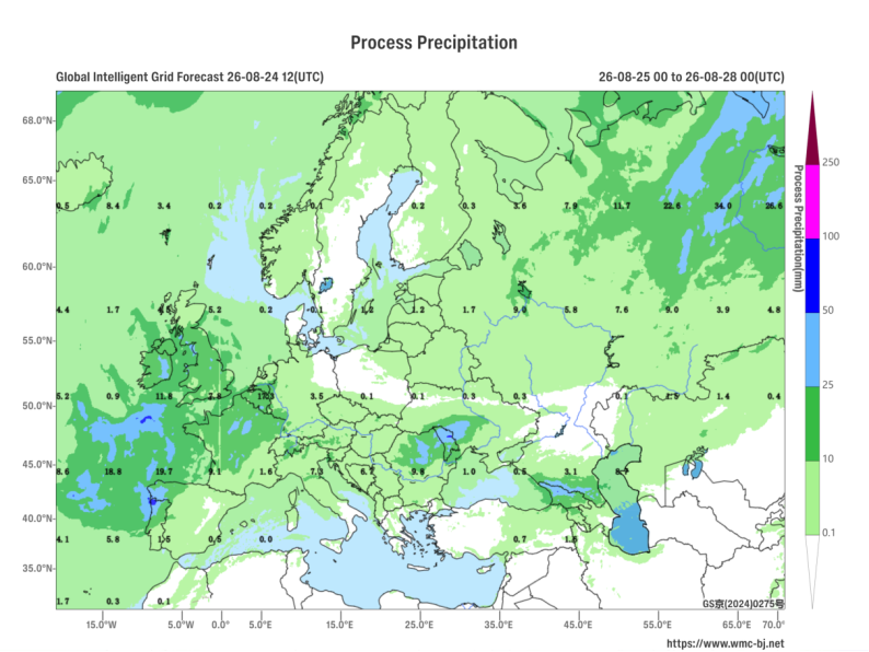
Figure 2: Forecast of Accumulated Precipitation from 00:00 on August 25 to 00:00 on August 28, 2026 (UTC) (Unit: mm)
https://www.wmc-bj.net

Author: You Yuan, Zhang Yani Reviewer: Zhou Ningfang
English reviewer:Wang Yi Issue approver:Dai Kan