Afghanistan and Pakistan are forecast to experience a new round of strong wind and precipitation processes
From April 6 to 8, under the combined influence of an upper-level trough, low-level warm and moist jet stream, and orographic lift (Figure 1), moderate to heavy rain is forecasted for Afghanistan and Pakistan, accompanied by winds of force 5 to 6 and gusts of force 7 to 9 (Figure 2). Among these areas, central Afghanistan and northwestern Pakistan will see torrential rain, with heavy snow to snowstorm or sleet in high-altitude mountainous regions. The cumulative precipitation during this period is projected to reach 15 to 40 mm, with 60 to 90 mm in some areas and locally exceeding 120 mm (Figure 3). Persistent precipitation is likely to trigger secondary disasters such as flash floods and mudslides. Relevant authorities and the public are advised to stay alert to the adverse impacts and take appropriate preventive measures.
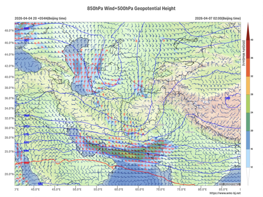
Figure 1. Forecast of 500 hPa Geopotential Height (contours, units: dagpm) and 850 hPa Wind Field (wind barbs, units: m/s) at 02:00 BJT on April 7, 2026
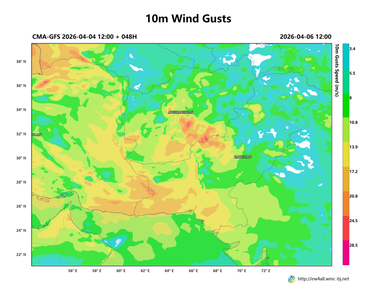
Figure 2. Forecast of Maximum Gust Wind Speed (Shaded, units: m/s) at 20:00 BJT on April 6, 2026
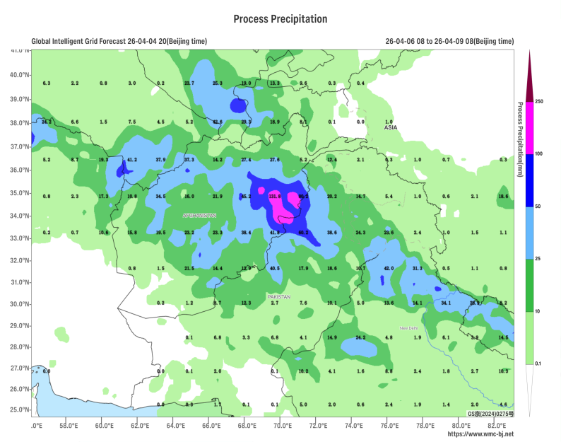
Figure 3. Forecasted Accumulated Precipitation from 08:00 BJT on April 6 to 08:00 BJT on April 9, 2026 (Shaded, Units: mm)
https://www.wmc-bj.net
![]()
Author: Che Jinning Reviewer: Guan Yue
English reviewer:Wang Yi Issue approver:Dai Kan