



The Philippine Islands to Experience Heavy Rain and Strong Winds
Influenced by the combined effects of Typhoon Kujira (Figure 1), the long-range moisture transport from Typhoon Dolphin, and the southwest monsoon (Figure 2), the central and northern Philippine Islands will experience persistent heavy rainfall. This precipitation event is characterized by its prolonged duration and massive accumulated totals. Over the next three days, moderate to heavy rain is expected in the central and northern Philippine Islands. Specifically, most of Luzon Island and Mindoro Island will see heavy rain to intense downpours, with exceptionally heavy downpours locally in the northwestern part of Luzon Island. Accumulated rainfall in the aforementioned areas will range from 80 to 150 mm, with some parts receiving 180 to 250 mm, and localized areas in northwestern Luzon exceeding 300 mm (Figure 3). Additionally, the central and northern Philippines and their adjacent waters will experience strong winds of force 6 to 8, with gusts reaching force 9 to 10. Precautions are advised against potential secondary disasters such as flash floods, landslides, and debris flows triggered by the persistent heavy precipitation.
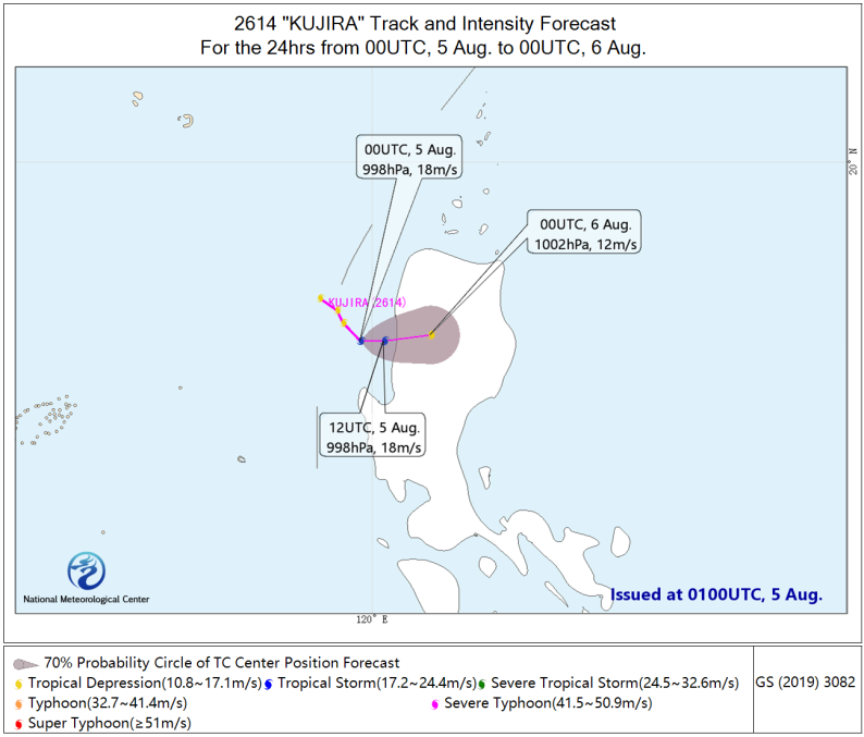
Figure 1. Probability Forecast Track for Typhoon Kujiki over the Next 36 Hours
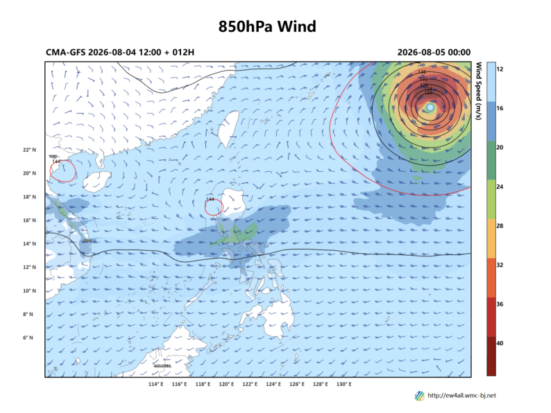
Figure 2. 850hPa Geopotential Height (contours, units: dagpm) and 850hPa Wind Field (barbs, units: m/s) at 00:00 UTC on August 5, 2026
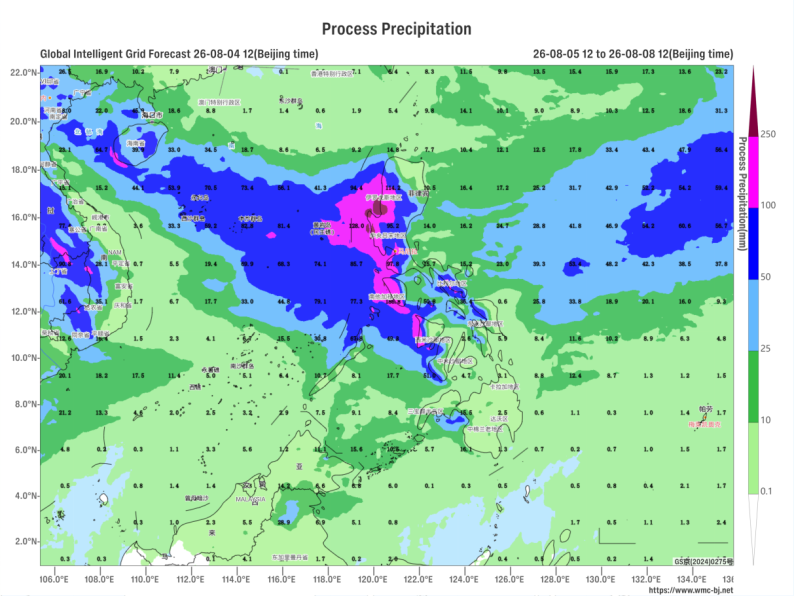
Figure 3. Forecast of Accumulated Precipitation from 12:00 on August 5 to 12:00 on August 8, 2026 (UTC) (Unit: mm)

Author: Huo Da Reviewer: Liu Xiaobo
English reviewer:Wang Yi Issue approver:Dai Kan