
Scattered showers will bring relief from the heatwave in France, Germany and neighboring areas
Starting on June 29, under the continuous influence of a high-pressure ridge, central France experienced high temperatures of around 35-38°C for approximately four days, with localized areas recording daily maximum temperatures exceeding 40°C. On July 2, some parts of Germany also saw maximum temperatures surpassing 35°C. It is forecasted that over the next three days, the western European region will transition to a pattern of increased shortwave system activity, with France and Germany experiencing light rain or scattered showers, leading to a relief from the high temperatures.
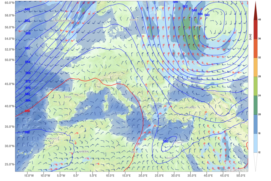
Figure 1: 500 hPa Geopotential Height (Contour, unit: dagpm), 850 hPa Wind Field (Wind Barbs) and Velocity (Shaded, unit: m/s) at 00:00 UTC on July 1, 2025
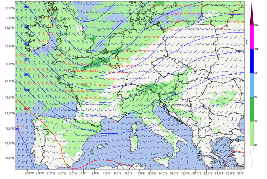
Figure 2: 500 hPa Geopotential Height (contours, unit: dagpm), 850 hPa Wind Field (wind barbs, unit: m/s), and 24-hour Precipitation Forecast (Shaded, unit: mm) at 12:00 UTC, July 6, 2025
![]()
Author: Li, Ming Reviewer: Zhang, Bo
English reviewer:Wang, Yi Issue approver:Dai,Kan