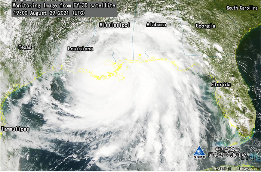
The hurricane IDA in the Gulf of Mexico has made landfall around 16:55 (Aug 29, 2021) (UTC, the same below),as a level-4 hurricane.
Analysis based on FY-3D meteorological satellite images, IDA had a small and round eye area with dense cloud wall structure outside the eye area, strong convection development in the spiral cloud belt on the north side.IDA's northern cloud has already affected parts of Louisiana, Mississippi and Alabama.In the near future, there is a high probability of heavy rain in its direction.
During Hurricane "IDA", National Meteorological Centre conducted the track and intensity forecasting analysis for expected severe weather.(Xian Di, Qian Qifeng)

Figure True Color Composite map monitored by FY-3D meteorological satellite
(19:00, Aug 29 UTC)
 京公网安备 11040102700102号