
Persistent Cold Weather Affects the Central and Eastern United States
Affected by the eastward movement of a cold vortex and an upper-level trough (Figure 1), the central and eastern United States experienced significant cooling and severe rain-snow weather over the past 24 hours. Over the next three days, these regions will continue to see temperature drops of 6-12°C, with areas east of the Mississippi River experiencing declines of 14-18°C, and states like Mississippi and Alabama facing drops exceeding 20°C (Figure 2). These conditions will be accompanied by winds of 4-7 on the Beaufort scale, with gusts reaching 8-9. Due to the persistent influence of the cold air, the average temperature in the central and eastern U.S. is expected to be 3-6°C lower than the normal for this time of year over the next ten days, with areas east of the Mississippi River seeing deviations of over 7°C. During this period, the 0°C isotherm will stretch across central Texas, coastal Louisiana, and northern Florida (Figure 3). Additionally, from January 25 to 26, heavy to severe snowfall is forecasted for the central and northeastern U.S. and southeastern Canada, with some areas experiencing extreme blizzard conditions. The southeastern U.S. will see moderate to heavy rain, with localized torrential downpours. Attention should be given to the adverse impacts of the severe cooling, heavy snowfall, and persistent low temperatures on transportation, agriculture, energy, and other sectors.
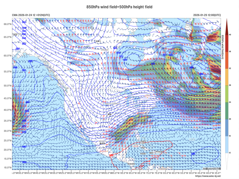
Figure 1. Forecast of 500 hPa Geopotential Height (units: dagpm) and 850 hPa Wind Field (units: m/s) at 12:00 (UTC) on January 25, 2026
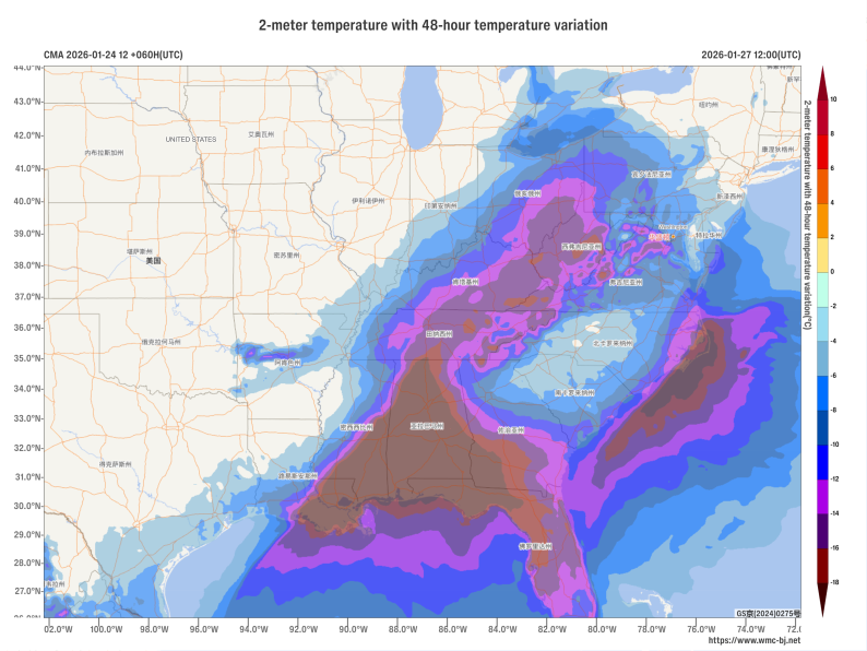
Figure 2. Forecast of Accumulated Temperature Drop from 12:00 on January 25 to 12:00 on January 27, 2026 (UTC)(Shaded areas indicate temperature drops of 4°C or more, Unit: °C)
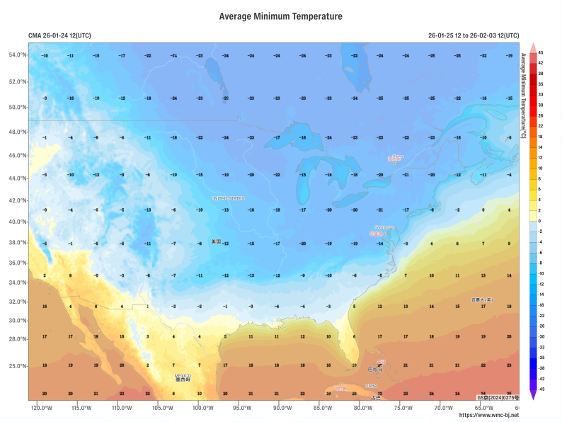
Figure 3. Forecast of Average Minimum Temperature from 12:00 on January 25 to 12:00 on February 3, 2026 (UTC) (Shaded, Unit: °C)
https://www.wmc-bj.net
![]()
Author: Huo Da Reviewer: Min Ying
English reviewer:Wang Yi Issue approver:Dai Kan