
Typhoon "FUNG-WONG" is Expected to Make Landfall in Northern Philippines
Typhoon Fung-wong, the 26th typhoon of this year, was located at 08:00 AM (Beijing time) today (the 8th) approximately 1240 kilometers east of Manila, the Philippines, over the northwestern Pacific Ocean, at 12.8 degrees north latitude and 132.3 degrees east longitude. The maximum wind speed near its center was 13 levels (40 meters per second), with a minimum central pressure of 960 hPa. It is expected that Fung-wong will move rapidly westward at a speed of 30-35 kilometers per hour, rapidly intensifying and potentially reaching super typhoon strength (55-65 meters per second, above 16-17 levels). The typhoon will gradually approach the eastern coast of Luzon, the Philippines, and weaken after crossing the island. It is forecasted to move into the South China Sea between noon and night on the 10th, subsequently turning gradually towards the northward direction (Figure 1).
Affected by Typhoon "Fung-wong", from the 8th to the 11th, the majority of the Philippines will experience severe rain and wind conditions. Central and northern regions of the Philippines are expected to face torrential or extremely heavy rain, with some areas experiencing extraordinary downpours, accompanied by strong winds of 8 to 9 on the Beaufort scale, with gusts exceeding 11 levels (Figure 2). Accumulated precipitation in most of these areas will range from 70 to 150 millimeters, with some regions receiving 150 to 250 millimeters, and locally exceeding 300 millimeters (Figure 3). The intense rain and wind are likely to disrupt power facilities, transportation, and cause the collapse of buildings. There is a high risk of secondary disasters such as flooding, landslides, and mudslides, necessitating advance precautions.
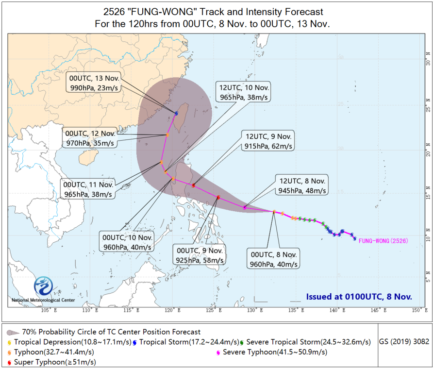
Figure 1: 120-Hour Probabilistic Track Forecast for Typhoon "Fung-wong"
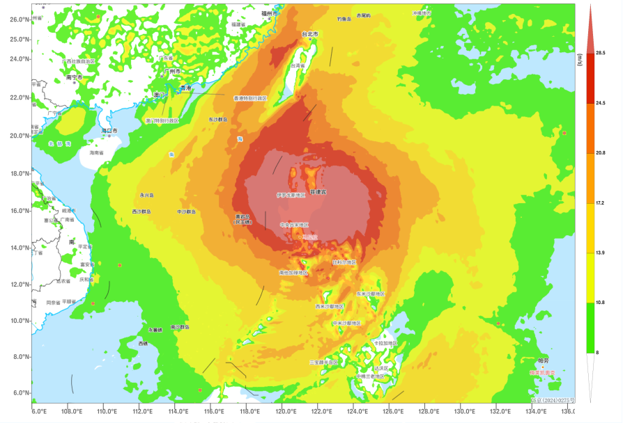
Figure 2: Maximum Gust Wind Speed (in m/s) for a 6-hour Period at 23:00 (Beijing Time) on November 9
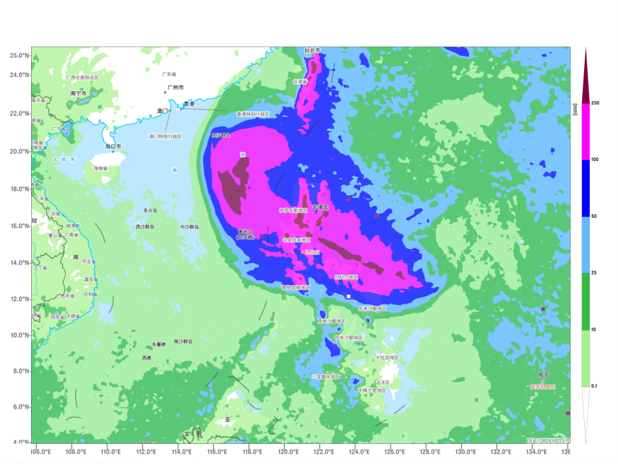
Figure 3: Forecast of Accumulated Precipitation from 20:00 on November 8 to 08:00 on November 11 (Beijing Time) (Unit: mm)
![]()
Author: Kong Linghan, Cao Mai Reviewer: Zhou Ningfang
English reviewer:Dai Kan Issue approver:Wang Yi