
Western Europe and Eastern United States Will Experience Significant Rainfall and Snowfall
From October 30 to November 3 (UTC), influenced by an upper-level trough, regions including Western Europe, southern Northern Europe, southern Central Europe, and central-western Southern Europe will experience moderate to heavy rain. Parts of northern Portugal and western Spain are expected to see heavy downpours or intense rain. Southern Norway will face moderate to heavy snow, with localized areas experiencing severe snowstorms or extreme snowfall (Figure 1). The cumulative precipitation during this period is forecasted to reach 20-50 mm, with some areas receiving 60-80 mm and localized regions exceeding 100 mm. This will be accompanied by strong winds of 5-6 on the Beaufort scale, with gusts reaching 7-8 and locally up to 9-10 (Figure 2).
From October 30 to November 2, influenced by a low vortex and cold air, the eastern United States will experience moderate rain, with localized heavy to torrential rain, moving from south to north. Labrador Peninsula will see light to moderate snow or sleet, with localized heavy snow (Figure 3). The cumulative precipitation during this period is expected to reach 20-40 mm, with localized areas exceeding 50 mm. This will be accompanied by strong winds of 5-6 levels, with gusts reaching 7-8 levels, and locally up to 9-10 levels (Figure 4).
Precautions are advised to mitigate the adverse impacts of the strong winds, rainfall, and snowfall on local power transmission and transportation.
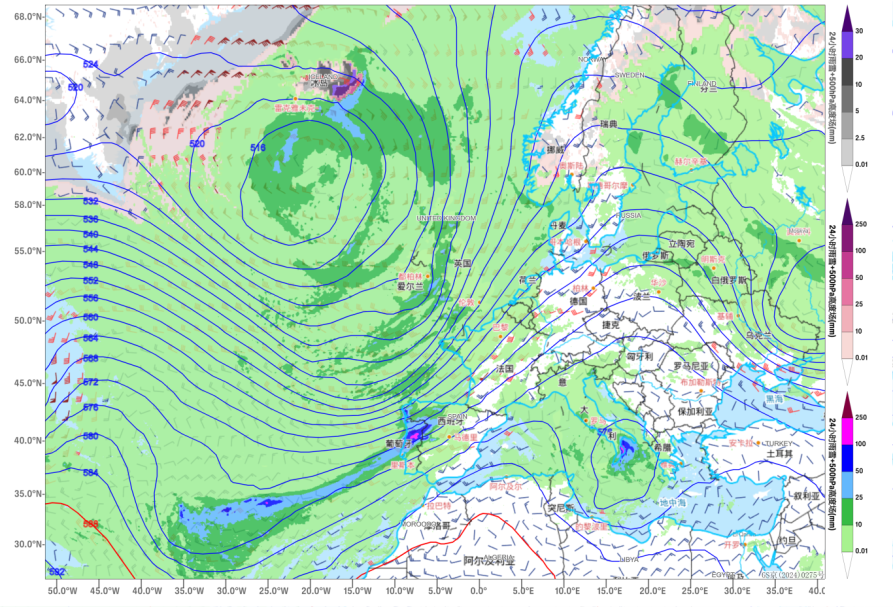
Figure 1 24-hour Precipitation (Rain and Snow) Situation Field at 00:00 on November 1 (Unit: mm)
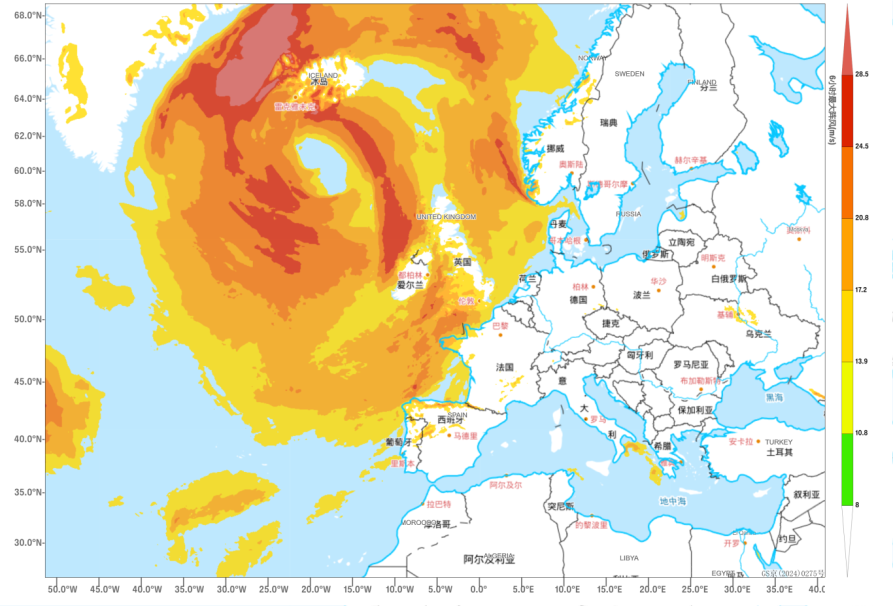
Figure 2 6-hour Maximum Gust from 18:00 on October 31 to 00:00 on November 1(Unit: m/s)
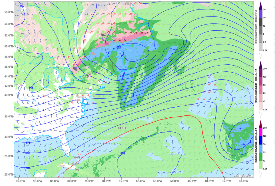
Figure 3 24-hour Precipitation (Rain and Snow) Situation Field at 12:00 on November 1 (Unit: mm)
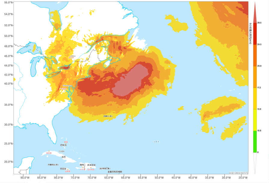
Figure 4 6-hour Maximum Gust from 18:00 on October 31 to 00:00 on November 1(Unit: m/s)
![]()
Author: Min Ying Reviewer: Liu Xiaobo
English reviewer:Wang Yi Issue approver:Dai Kan