The flood disaster caused by heavy rainfall has impact on British Columbia, Canada in recent days.
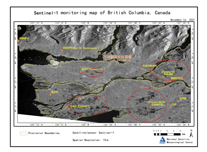
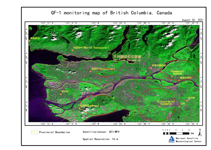
The Sentinel-1 (November 16, 2021) and GF-1 (August 30, 2021) satellite data are used to monitor the flood in this region. The results show that, new flooded areas appeared in southern British Columbia on November 16 Compared to August 30 (Red circle areas in Fig.1 and Fig.2). The new flooded areas are mainly distributed around Vancouver, Ladner, Cloverdale and Hammond, and the flooded areas are mainly farmland. (Source: NSMC)


