Mexico and New Zealand Will Experience Heavy Rain
From October 8 to 10, influenced by the Intertropical Convergence Zone (ITCZ) to the south of the subtropical high (Figure 1), southern Mexico will experience moderate to heavy rainfall, with torrential or extreme downpours in coastal areas. Accumulated precipitation is expected to reach 40-80 mm, with some regions can reach 100-150 mm and localized areas exceeding 200 mm (Figure 2). Additionally, from October 8 to 12, a slow-moving upper-level trough (Figure 3) will bring persistent heavy rainfall to the western part of New Zealand, with torrential or extreme downpours in coastal regions. Accumulated precipitation is forecasted to be 50-100 mm, with certain areas reaching 120-200 mm and localized totals surpassing 250 mm (Figure 4). This will be accompanied by strong winds of 5-6 on the Beaufort scale, with gusts of 7-8 and locally reaching 9-10. Attention should be given to the potential secondary disasters triggered by the heavy rainfall, such as flooding, landslides, debris flows, and urban waterlogging, as well as the adverse impacts of the strong winds on local production and daily life.
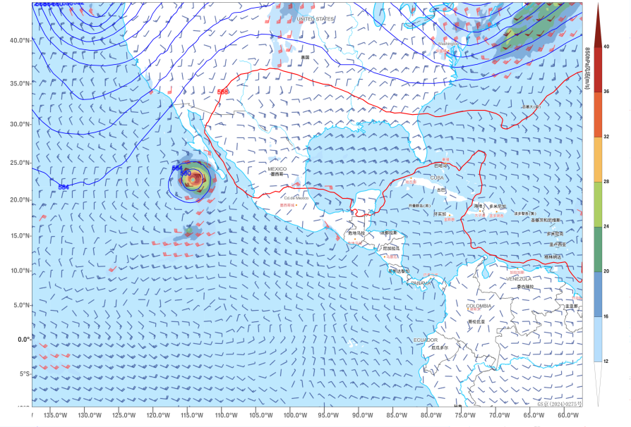
Figure 1 Forecast of 500 hPa Geopotential Height and 850 hPa Wind Field at 00:00 UTC on October 9
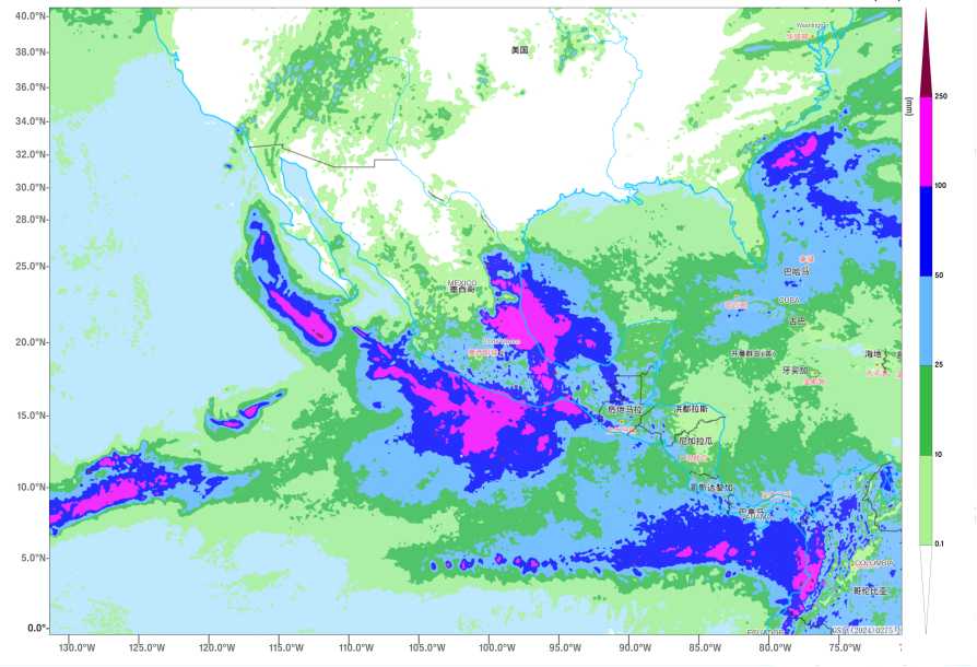
Figure 2 Forecasted Accumulated Precipitation from October 8 to 10 (Unit: mm)
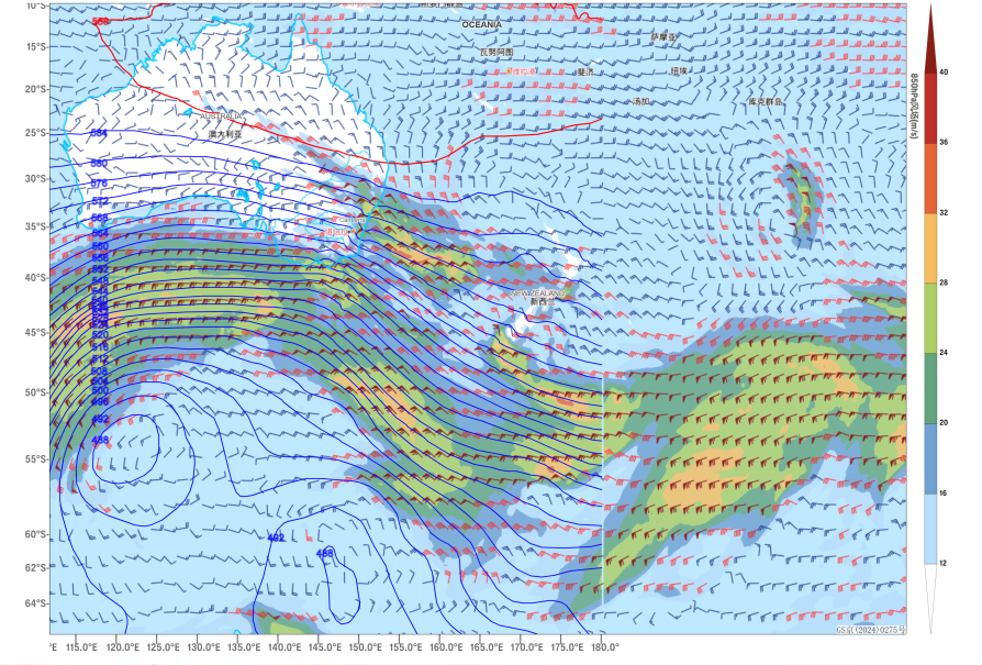
Figure 3 Forecast of 500 hPa Geopotential Height and 850 hPa Wind Field at 00:00 UTC on October 9
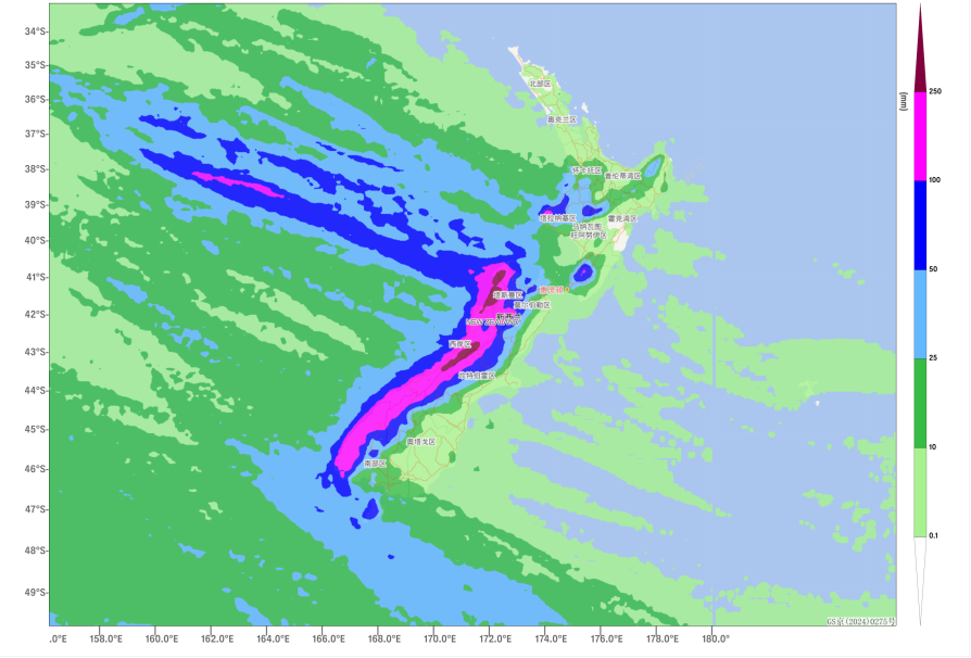
Figure 4 Forecasted Accumulated Precipitation from October 8 to 12 (Unit: mm)
![]()
Author: Xie Jin Reviewer: Cai Xiangning
English reviewer:Wang Yi Issue approver:Dai Kan