
Northern and Central Japan will Experience Severe Wind and Snowstorm
Affected by the eastward movement of an upper-level cold vortex (Figure 1), it is expected that the next three days, some areas in central and northern Japan will experience heavy snow to blizzard, with localized severe blizzard or extremely severe blizzard. During this period, the accumulated snowfall is 10~20 mm, and locally it can reach over 25 mm (Figure 2). The temperature in the above-mentioned areas will drop by 6~10 ℃, and locally may exceed 12 ℃ (Figure 3), accompanied by winds of 7~8 levels on the Beaufort scale, with gusts reaching 8~9 levels (Figure 4). Attention should be paid to the adverse effects of strong snowstorms on local power facilities, transportation, and other industries.
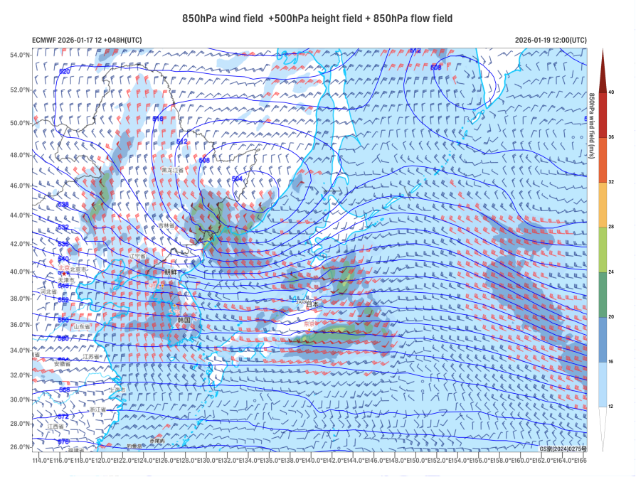
Figure 1. 500 hPa Geopotential Height (units: dagpm) and 850 hPa Wind Field (units: m/s) at 12:00 (UTC) on January 17, 2026
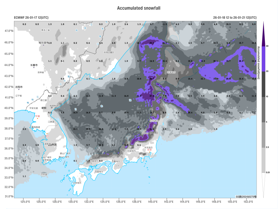
Figure 2. Accumulated Snowfall from 12:00 on January 18 to 12:00 on January 21, 2026 (UTC), in millimeters (units: mm)

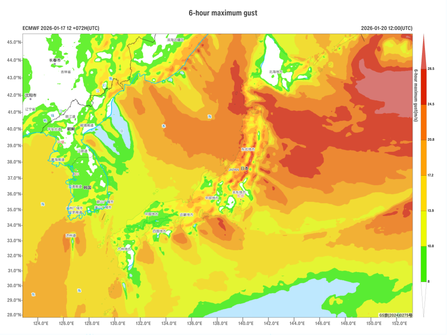
Figure 3. Maximum Gust Wind Speed (units: m/s) for 6 Hours at 12:00 (UTC) on January 20, 2026
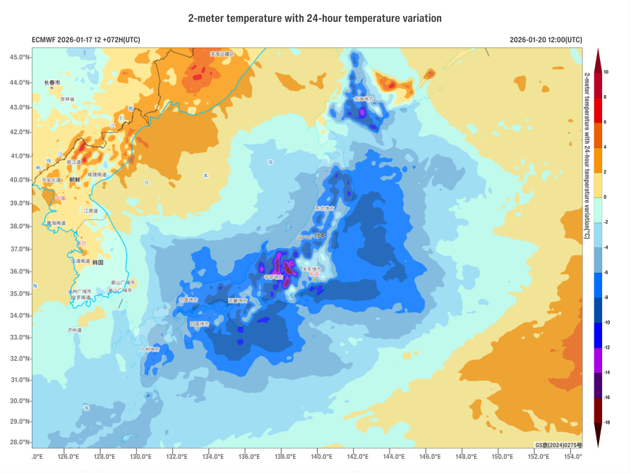
Figure 4. 24-hour Temperature Change at 2 meters (Units: °C) as of 12:00 (UTC) on January 20, 2026
https://www.wmc-bj.net
![]()
Author: Xu Xianhuang Reviewer: Cai Xiangning
English reviewer:Wang Yi Issue approver:Dai Kan