
A strong cold air mass is active in Central and Eastern Europe
It is forecasted that in the coming week, influenced by the eastward movement of an upper-level trough (Figure 1), a strong cold air mass will sweep from west to east across central and eastern Europe and northwestern Asia. Regions including southern Poland, Belarus, central and southern Eastern Europe, Ukraine, Moldova, northern Romania, western Uzbekistan, and Kazakhstan will experience temperature drops of 8-10°C, with localized areas seeing more than 16°C (Figure 2). This will be accompanied by strong winds of 6-7 levels, with localized gusts exceeding 8 levels. Moderate to heavy rain is expected in these regions, with isolated heavy downpours. Attention should be given to the adverse impacts of the temperature drop and strong winds on power facilities, transportation, and other industries in the affected areas.
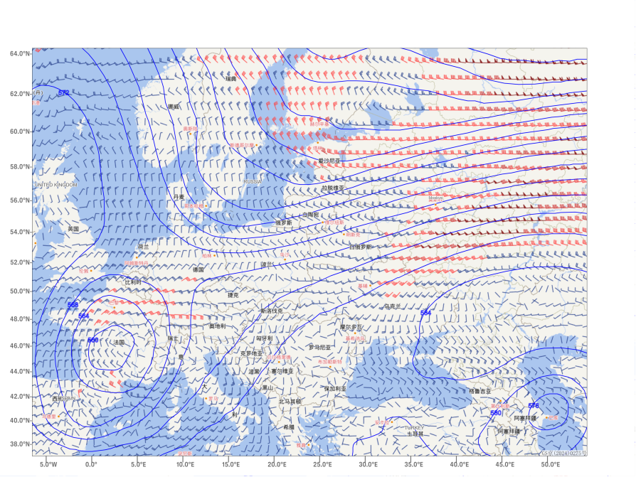
Figure 1: Forecast of 500 hPa Geopotential Height and 850 hPa Wind Field at 20:00 on September 23
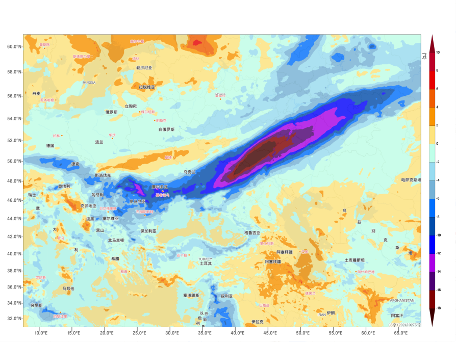
Figure 2: 24-Hour Temperature Change Forecast at 2 meters above ground level as of 20:00 on September 25
![]()
Author: Zhao Wei Reviewer: Cai Xiangning
English reviewer:Wang Yi Issue approver:Dai Kan