
Short-duration heavy rainfall and other severe convective weather are expected in central and northern Japan
Affected by the Meiyu front, from June 23 to 24, central Japan and the Kinki region experienced significant rainfall, with accumulations ranging from heavy rain to torrential downpours, and localized areas witnessing extremely heavy or exceptional rainfall (Figure 1). Specifically, Gifu Prefecture and Mie Prefecture encountered short-duration intense rainfall, with hourly rainfall rates reaching 30-80 mm, and locally up to 120 mm.
It is forecasted that from the night of June 25th to June 26th, influenced by a cold vortex over the Sea of Japan and the remnants of Tropical Depression "Sepat" (Figure 2), widespread moderate rain is expected in central and northern Japan. Specifically, western Central Japan, northern Kanto, and the Tohoku region will experience heavy to torrential rain, with localized extreme downpours (Figure 3). Some areas will be accompanied by short-duration intense rainfall (hourly rainfall intensity of 20-50 mm, locally exceeding 80 mm), thunderstorms, strong winds, and tornadoes. Given the high overlap with the previous rain belt and the extreme intensity of localized rainfall, precautions are necessary against secondary disasters such as landslides, flooding in low-lying areas, and rising river levels.

Figure 1. Accumulated Precipitation from June 23-24, 2025 (Unit: mm)
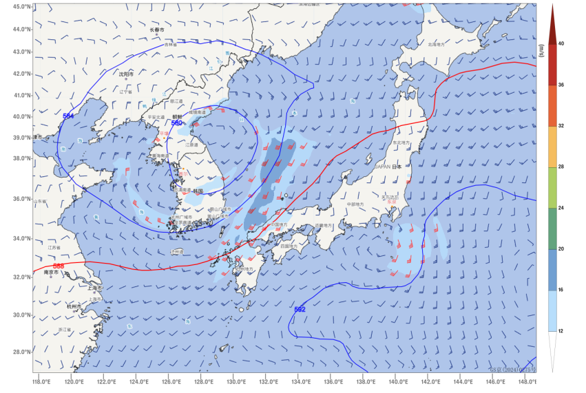
Figure 2. 500 hPa Geopotential Height (contours, units: dagpm) and 850 hPa Wind Field (wind barbs, units: m/s) at 1200 UTC on June 25, 2025
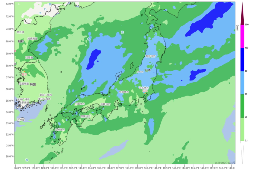
Figure 3. Forecasted Accumulated Precipitation from Night of June 25 to June 26, 2025 (Unit: mm)
![]()
Author: Huo Da Reviewer: Niu Ruoyun
English reviewer:Wang Yi Issue approver:Dai Kan