
Northeastern and Western Indian Peninsula Will Experience Heavy Rainfall
Japan Will Experience Severe Wind and Rainfall
From October 30 to November 1 (UTC), influenced by the residual circulation of the weakened Cyclonic Storm "Monsa" in the Bay of Bengal, parts of central and eastern India, northern India, eastern Nepal, northwestern Bangladesh, and Bhutan are expected to experience moderate to heavy rainfall, with some areas facing torrential rain and localized extremely heavy downpours. The cumulative rainfall in most regions is anticipated to reach 50-80 mm, with some areas potentially receiving 120-180 mm, and localized totals exceeding 200 mm. Additionally, affected by the peripheral circulation of a tropical disturbance in the Arabian Sea, the state of Gujarat in India will continue to experience significant rainfall, with coastal areas likely to see heavy to very heavy rain (Figure 1).
From October 30 to November 2, influenced by a surface cyclone, Japan will experience moderate to heavy rainfall, with some areas facing torrential rain and localized extreme downpours (Figure 2). The cumulative precipitation during this period is expected to reach 30-60 mm, with some regions receiving 70-90 mm and localized areas exceeding 120 mm. This will be accompanied by strong winds of 6-7 on the Beaufort scale, with gusts reaching 8-9 and locally up to 10-11 (Figure 3).
Attention should be given to the adverse impacts of the strong winds and rain on local power facilities, transportation, and other sectors, as well as to the prevention of secondary disasters such as flooding, landslides, and mudslides that may be triggered by the intense rainfall.
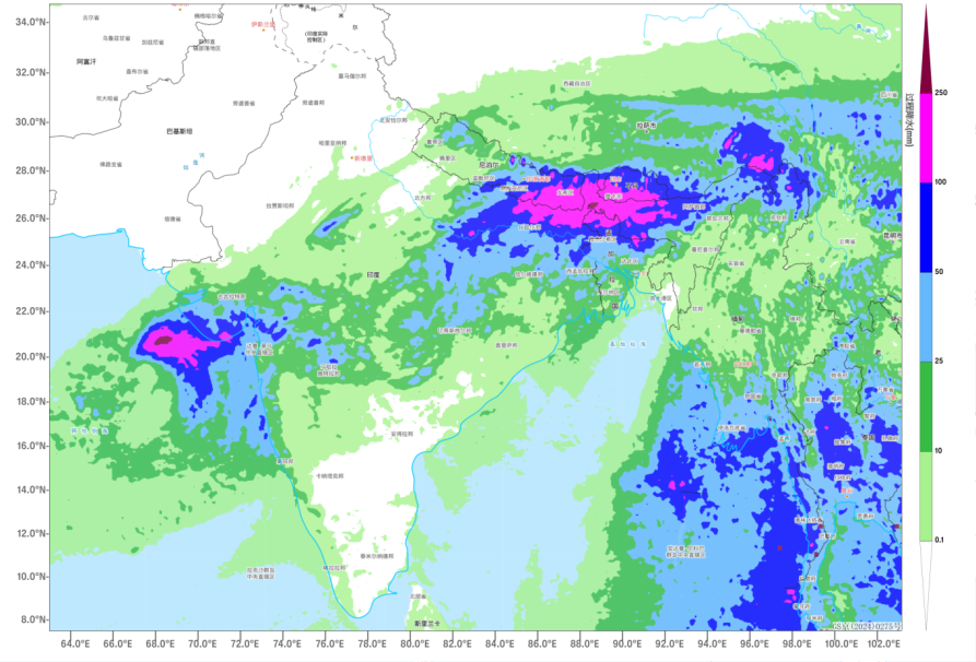
Figure 1 Accumulated Rainfall from 00:00 on October 30 to 00:00 on November 1 (Unit: mm)
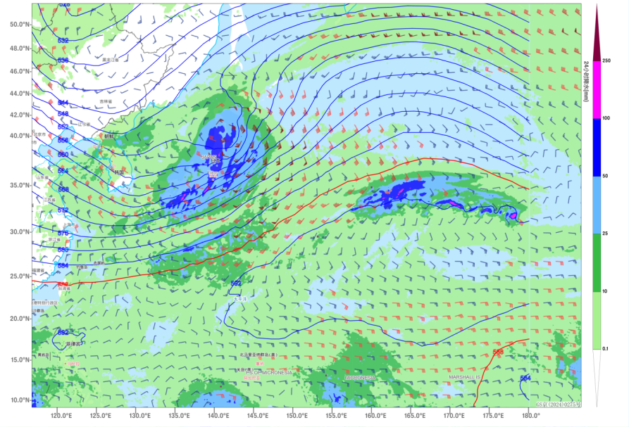
Figure 2 24-hour Precipitation Situation Field at 00:00 on November 1 (Unit: mm)
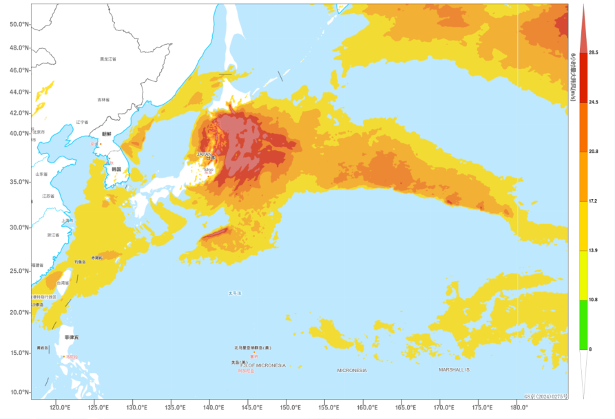
Figure 3 6-hour Maximum Gust from 18:00 on October 31 to 00:00 on November 1(Unit: m/s)
![]()
Author: Min Ying Reviewer: Liu Xiaobo
English reviewer:Wang Yi Issue approver:Dai Kan