
"MEGAN" will Land in Northe of Austrilia
Weather Monitoring
Severe Tropical Cyclone (STC) "MEGAN" was located in the ocean near the Australia at 00:00 UTC March 18th, 2024, and will move in south west direction at about 5 kilmometers per hour. After crossing the Gulf of Carpentaria, it will land in the coast of Northern Australia in today night, then it will be weaken and move west-south.
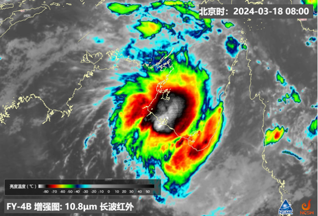
Figure 1: FY-4B Infrared imagery for STC "MEGAN" at 00 UTC March 18th, 2024
2、Forecast
Affected by "MEGAN", there was obvious rainfall in norhern Queensland in Marh 17th, it is expected from 18th to 23th, Queensland and northern areas will continue raining, some area will have heavy rain. especially in 18th-19th, March, the southern coast of the Gulf of Carpentaria will have strong wind and rain, the local precipitation will have more than 200 mm, the gale will 10-12 Beaufort scale, and the local gust will up to 13-14 Beaufort scale .
From 20th to 23th, the weakened circulation moved slowly to the south-west direction, which will continue to affect northern Australia, and some parts of the south-north area will have heavy rain. The precipitation will bring significant cooling, and the high temperature in the above areas will be significantly descend.
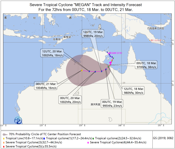
Figure 2. Track and intensity forecast of "MEGAN".
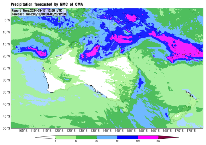
Figure 3. Accumulated precipitation forecast from 00 UTC 18th to 12 UTC 23th March.
![]()
Author: Xiangchunyi LIu,Liu Yi Reviewer: Zhou Ningfang
English reviewer: Wang Yi Issue approver: Dai Kan