
The North Atlantic tropical storm "Beryl" is expected to make landfall in Texas, United States
The tropical storm "Beryl" in the North Atlantic was located about 285 kilometers south-southwest of Houston, Texas, USA, at 00:00 UTC on July 8th (27.1°N, 95.6°W). The minimum central pressure was 987 hPa, and its intensity has increased from level 10 to level 11 in the past 24 hours.
Beryl will move northwesterly at an average speed of 20 kilometers per hour, with a slight intensification in strength. It is expected to make landfall on the central coast of Texas, USA, around 12:00 UTC on the 8th, with a tropical storm or Category 1 hurricane intensity (11-13 grades, 30m/s-38m/s, equivalent to a severe tropical storm or typhoon level in our country). After landfall, it will turn northeastward, with its strength gradually weakening. Affected by this, large to heavy rain will successively affect the central, southern, and northeastern regions of the United States from the 8th to the 11th. Local areas may experience extremely heavy rainstorms. In the aforementioned regions, winds of 6 to 7 levels with gusts up to 8 to 9 levels are expected. The wind near the center of the typhoon can reach 9 to 10 levels, with gusts up to 11 to 13 levels.
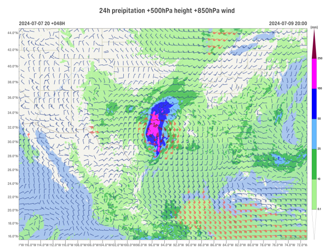
Figure 1. Forecasted rainfall from July 7, 2024, for July 9 (unit: mm)
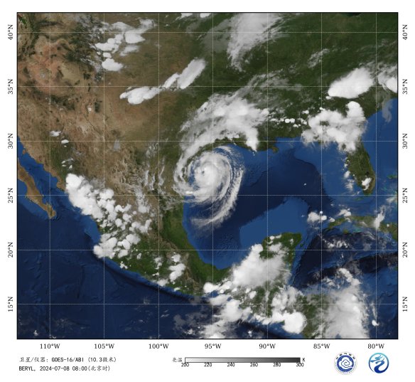
Figure 2: Satellite Infrared Monitoring Image (00:00 UTC, July 8, 2024)
![]()
Author: Qin Huafeng Reviewer: Guan Yue
English reviewer:Wang Yi Issue approver:Dai Kan