Typhoon "YAGI" will bring strong rainfall and wind to the Philippines
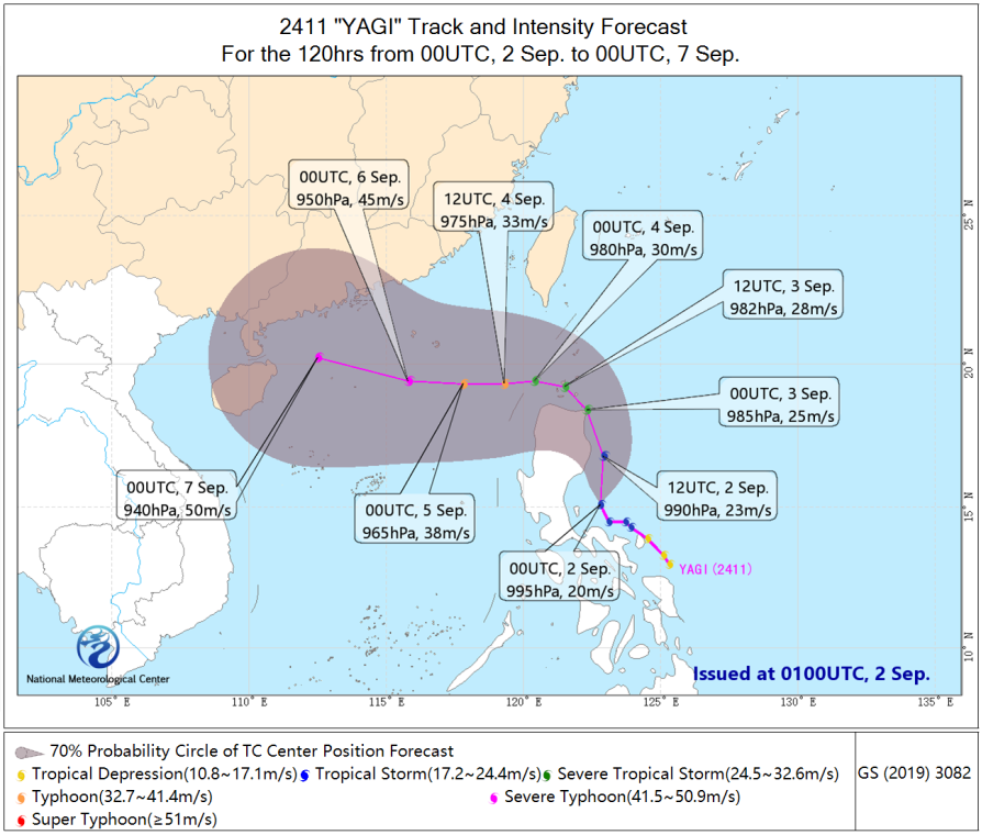
The tropical depression east of the Philippines has intensified into Typhoon "Yagi", the 11th typhoon of the year 2024, in the evening of September 1. At 00:00 UTC on September 2, its intensity was "tropical storm" with the center located over the sea near the eastern coast of the Philippines. It is expected that "Yagi" will move northward at a speed of 15 to 20 kilometers per hour along the eastern coast of Luzon Island, Philippines, with its intensity gradually strengthening. From September 3, it will start moving west-northwestward, traversing the Bashi Channel, and enter the northern part of the South China Sea during the day of September 4.
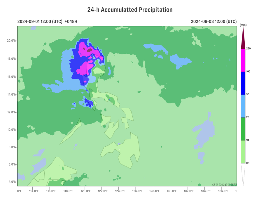
Influenced by "Yagi", from September 2 to 5, heavy rainfall will occur in the central and northern parts of the Philippine Islands, with locally extremely heavy rainstorm. The Philippine Islands and their adjacent sea areas will experience gales of 6 to 8 levels, with gusts reaching 9 to 10 levels. The wind near the sea area where the center of "Yagi" passes can reach 9 to 10 levels, with gusts up to 11 to 12 levels.

Figure 1 Typhoon "Yagi" Track Forecast

Figure 2. Quantitative precipitation forecast from 12:00 UTC September 2 to 12:00 UTC September 3
![]()
Author: Lv Xinyan, Gao Shuanzhu, Quan Wanqing Reviewer: Yang Shunan
English reviewer:Yang Shunan Issue approver:Dai Kan

