Severe rain and wind weather is affecting Mexico
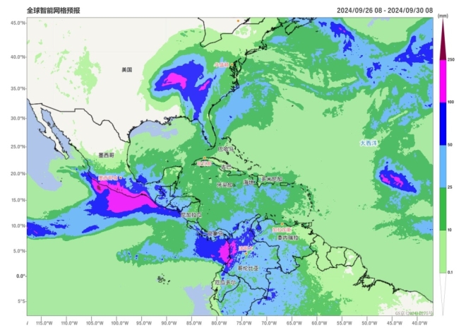
Affected by the Tropical Storm "JOHN" in the Northeast Pacific, there are heavy to rainstorm in central and southern Mexico, heavy rainstorm in some areas, and local extremely heavy rainstorm from September 26 to 29, which may be accompanied by geological disasters such as flash floods and mudslides. At the same time, there are 8-10 levels winds, and local gusts can reach 11-12 levels.
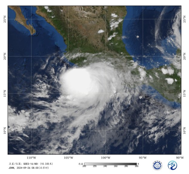
At 08:00 BT on September 26, the "John" is located about 85 kilometers to the southwest of Zihuatanejo, Guerrero, Mexico, at 16.9 °N and 101.8 °W. The central pressure was 984 hPa, with maximum winds reaching 10 levels (25 meters per second, equivalent to a severe tropical storm according to the Chinese classification). "John" will slowly move towards the northwest direction at a speed of 5-10 kilometers per hour, with increasing intensity, and will make landfall again on the southwestern coast of Mexico.
In addition, under the influence of Hurricane “HELENE” in the North Atlantic, there were also heavy to rainstorm, and local heavy rainstorm in the United States, Cuba and other areas,and extremely heavy rainstorm in the eastern and southern parts of the United States from September 26 to 29. The wind speed can reach 10-12 levels, and locally 13-15 levels.

Figure 1. Accumulated precipitation forecast from September 26 to 29, 2024

Figure 2 Figure 1 Satellite infrared monitoring image (Beijing time 08:00 on September 26, 2024)
The "John" is moving in a northerly direction
![]()
Author: Liu Yi Reviewer: Liu Xiaobo
English reviewer:Wang YI Issue approver:Dai Kan

