
The tropical cyclone "SEAN" will affect the northwestern part of Australia
On January 19, 2025, at 08:00 Beijing Time, a tropical cyclone named "SEAN" of category one intensity formed in the waters approximately 330 kilometers northeast of Exmouth, Western Australia (at latitude 19.6 degrees south, longitude 116.1 degrees east), with a central pressure of 989 hPa and maximum sustained winds reaching 9 levels (23 meters per second) (see Figure 1).
It is predicted that Tropical Cyclone "SEAN" will move southwestward at a speed of 15 to 20 kilometers per hour, with its intensity gradually strengthening. Under its influence, from January 19th to 21st, there will be heavy rain and windy weather in the northwestern part of Australia. The coastal areas of northwestern Western Australia and other regions will experience heavy to severe rainstorms, with locally extremely heavy rain (Figure 2). Parts of the aforementioned areas will experience winds of 5 to 7 levels, with gusts reaching 8 to 10 levels, and there will be winds of 7 to 9 levels with gusts of 10 to 12 levels in the adjacent waters of Western Australia.
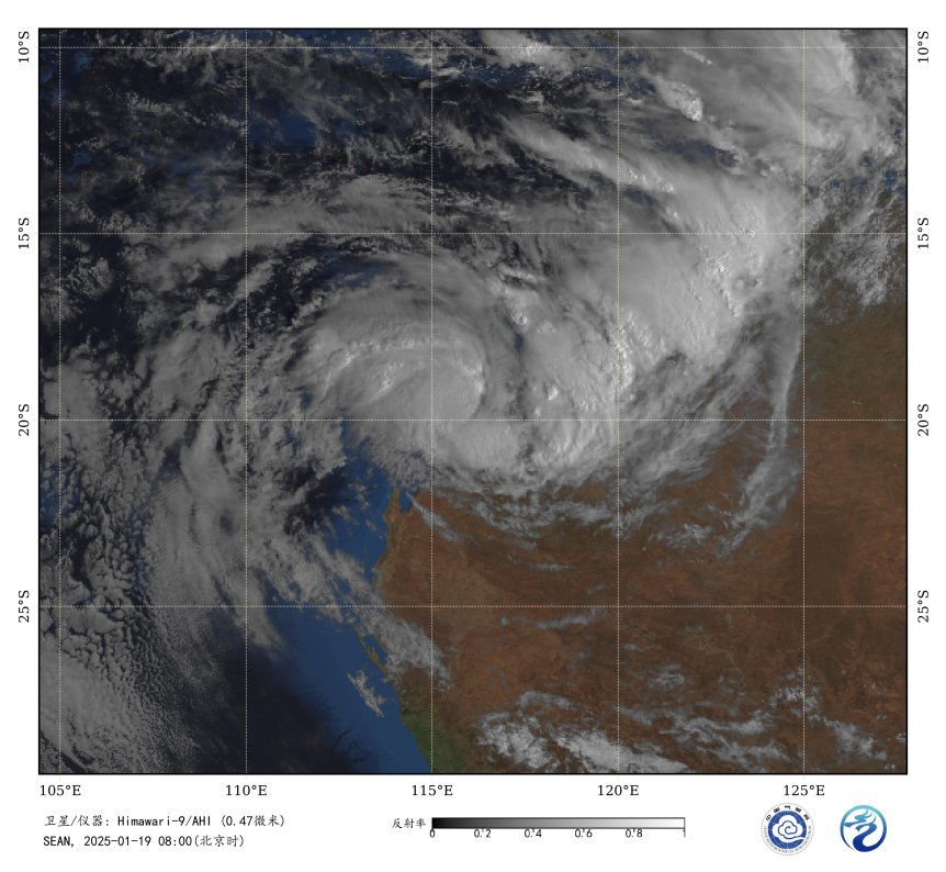
Figure 1. Satellite Infrared Monitoring Image (Beijing Time 08:00 on January 19, 2025)
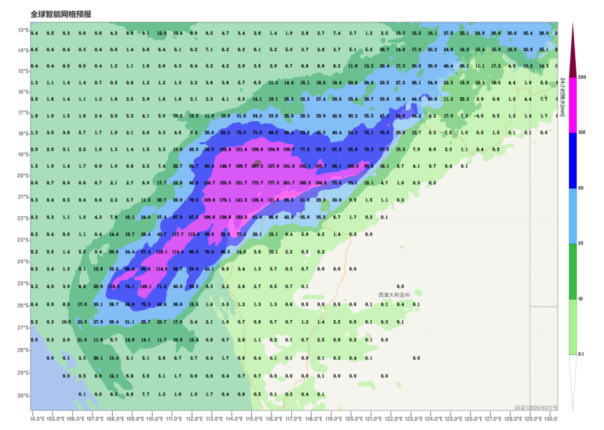
Figure 2. Cumulative precipitation from January 19 to 21, 2025 (Beijing Time), (Unit: mm)
![]()
Author: Huo Da Reviewer: Bao Yuanyuan
English reviewer:Wang Yi Issue approver:Dai Kan