
Severe winter storms are expected to hit multiple states in the southeastern United States
Affected by the cold wave, there will be significant wind and rain weather in the eastern and southern United States from January 19th to 23rd. Medium to heavy snow or sleet (transitioning to snow) is expected in multiple states in the southeastern United States. In particular, the southeastern part of Texas, Louisiana, southern Mississippi, southeastern Georgia, and eastern South Carolina will experience heavy to severe snowfall, with locally extreme heavy snow. The accumulated snowfall during this process can reach 20–30 millimeters (Figure 1). The states of Florida and northeastern Mexico will see light to moderate rain. In the aforementioned areas, there will be sustained winds of 5–7 levels with gusts reaching 8–9 levels, and the northern Gulf of Mexico will experience winds of 7–9 levels with gusts up to 10–11 levels (Figure 2). It is necessary to be vigilant against the adverse effects of the blizzard on power transmission and shipping traffic.
Additionally, parts of the central and eastern United States, as well as northeastern Mexico, will experience a temperature drop of 12 to 16 degrees Celsius, with local cooling in areas such as Mississippi and Alabama exceeding 20 degrees Celsius. By the morning of the local time on the 22nd, the 0-degree Celsius line will be pushed southward to a line extending from northern Mexico to northern Florida (Figure 3).
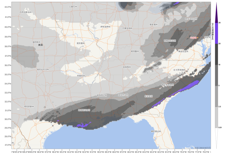
Figure 1. Accumulated snowfall in the southeastern United States from January 19 to 23, 2025 (Beijing time) (Unit: mm)
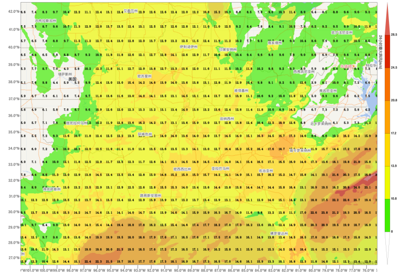
Figure 2. Maximum gust wind speed in the southeastern United States from January 19 to 23, 2025 (Beijing time) (Unit: m/s)
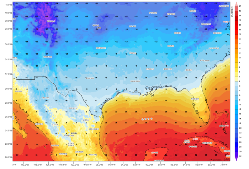
Figure 3. Minimum temperatures in the southeastern United States at 08:00 (local time) on January 22, 2025 (Unit: ℃)
![]()
Author: Huo Da Reviewer: Bao Yuanyuan
English reviewer:Wang Yi Issue approver:Dai Kan