
The eastern United States will experience another cold wave with widespread rain and snow
Since early February, the polar cold vortex has split, with one side of the center tilting towards Baffin Island. The rear of the polar cold vortex has continuously sent strong cold air southward, affecting Canada and the United States, bringing multiple episodes of extensive rain and snow. According to the Fengyun-3 satellite's integrated snow depth product (Figures 1-2), from February 1st to 12th, the area of snow cover in the United States increased, particularly from the 8th to the 11th, with a continuous expansion of the snow-covered area. By the 12th, the snow-covered area approached 4 million square kilometers, with the snow cover in Montana exceeding 350,000 square kilometers during the period from the 9th to the 12th. In parts of Washington, Idaho, Montana, Minnesota, Wisconsin, Colorado, as well as Michigan, Pennsylvania, New York, and Maine, the snow depth exceeded 50 cm.
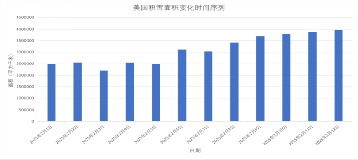
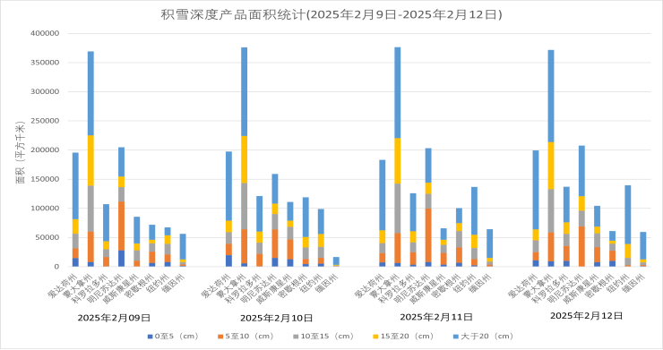
Figure 1. Changes in the snow-covered area in the United States from February 1 to 12, 2025 (Unit: km2)
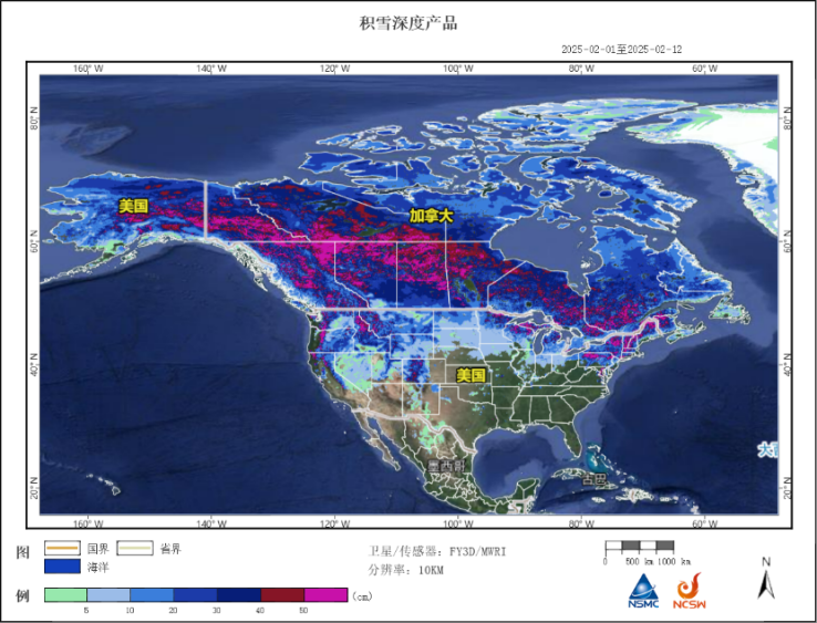
Figure 2: Fengyun-3 satellite integrated deep-threshold snow cover product (Beijing time, February 1-12, 2025)
It is anticipated that on the 14th, as the Atlantic high-pressure system intensifies, the southwestern warm and humid airflow from the Gulf of Mexico will strengthen. At the same time, the low vortex cyclone over Baffin Island will move southward to the Hudson Bay in Canada, continuously spreading cold air southward. It is expected that from the night of the 15th to the 17th, the collision of cold and warm air streams will be intense over the eastern United States, leading to a wide-ranging rain and snow event. The northeastern region will experience heavy to severe snowfall, with locally extreme blizzard conditions, while the southeastern part will see heavy to torrential rains. From the 16th to the 17th, most of the central and eastern United States will experience a temperature drop from north to south, with temperatures falling by 10 to 14 degrees Celsius, locally exceeding 18 degrees Celsius. This will also be accompanied by strong winds, with gusts reaching above level 8.
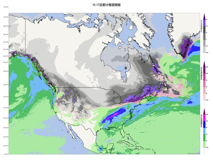
Figure 3 Forecast Map of Accumulated Precipitation from February 13 to 15, 2025 (Beijing Time) (Unit: mm)
![]()
Author: Shi Rui, Zhang Yan Reviewer: Zhou Ningfang
English reviewer:Wang Yi Issue approver:Dai Kan