
Severe storm and rain weather is affecting eastern Australia
At 0800 BST on March 4th, the center of Tropical Cyclone "ALFRED," a Category Two storm, was located approximately 630 kilometers to the east of Brisbane, Queensland, Australia, at 27.3 degrees South,159.4 degrees East. The central pressure was 982 hPa, with maximum sustained winds near the center reaching grade 10 (25 m/s).
It is expected that Tropical Cyclone "ALFRED," a Category Two tropical storm, will move southwestward at a speed of 15-20 kilometers per hour, gradually heading towards the eastern coast of Australia, with minimal changes in intensity. From the 5th to the 8th, moderate to heavy rain will affect southeastern Queensland and northeastern New South Wales in Australia, with locally heavy or extremely heavy rain. The accumulated rainfall may reach 150 to 200 millimeters, locally exceeding 250 millimeters. This will be accompanied by strong winds of 8 to 9 levels, with gusts reaching 10 to 11 levels. The heavy rain may trigger flash floods and mountainous torrents. Local authorities should take precautions against the adverse effects brought by this intense storm and windy weather.
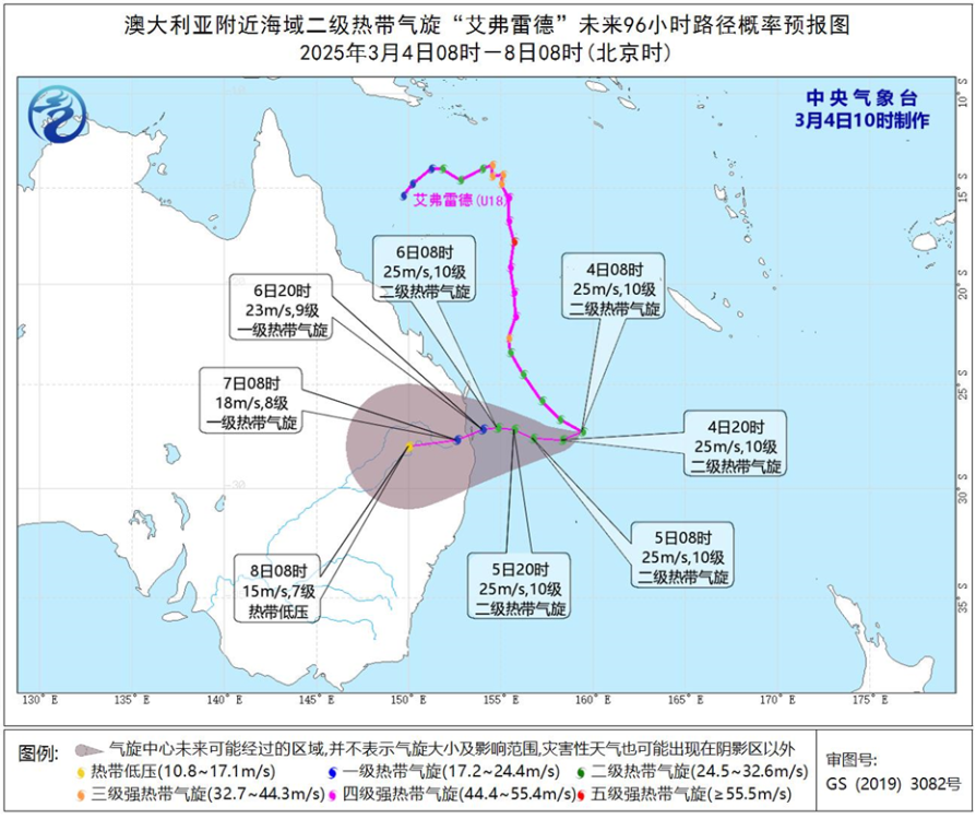
Figure 1: Probability Forecast Map of Typhoon Path in the Next 96 Hours
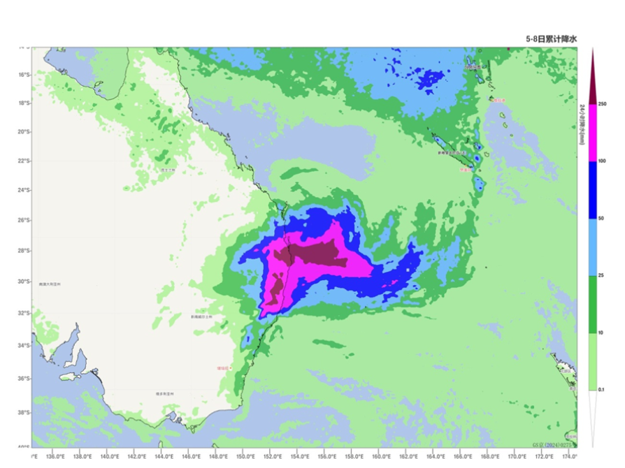
Figure 2. Forecast Map of Cumulative Precipitation from March 5 to 8, 2025 (Beijing Time), in units of mm
![]()
Author: Liu Yi Liu Longsheng Reviewer: Niu Ruoyun
English reviewer:Wang Yi Issue approver:Dai Kan