
A new round of cold wave will affect most areas of North America
Influenced by the eastward movement of the upper-level trough (Figure 1), most of North America will experience a new round of cold wave weather. It is expected that from March 14 to 18, areas including southern Canada and the Labrador Peninsula, most parts of the United States, northern and eastern Mexico, will successively experience a temperature drop of 8 to 14 degrees Celsius from west to east. Among these, some areas in the northern and eastern United States and the Labrador Peninsula of Canada will see temperature decreases exceeding 18 degrees Celsius. Parts of these areas will also be accompanied by 4 to 6-degree winds, with gusts reaching 7 to 8 degrees, and southern United States gusts may reach 9 to 10 degrees (Figure 2). Southern Canada, the western and northern United States will experience moderate to heavy snow or sleet, with locally severe blizzards; the Labrador Peninsula of Canada, the coastal areas of the western United States, and the central and eastern regions will receive moderate to heavy rains, with locally heavy rainstorms (Figure 3); the southeastern United States will experience severe convective weather such as hail and tornadoes.
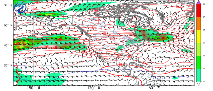
Figure 1. Mean geopotential height (contours) at 500 hPa and wind field (barbs) at 850 hPa from March 14 to 18, 2025
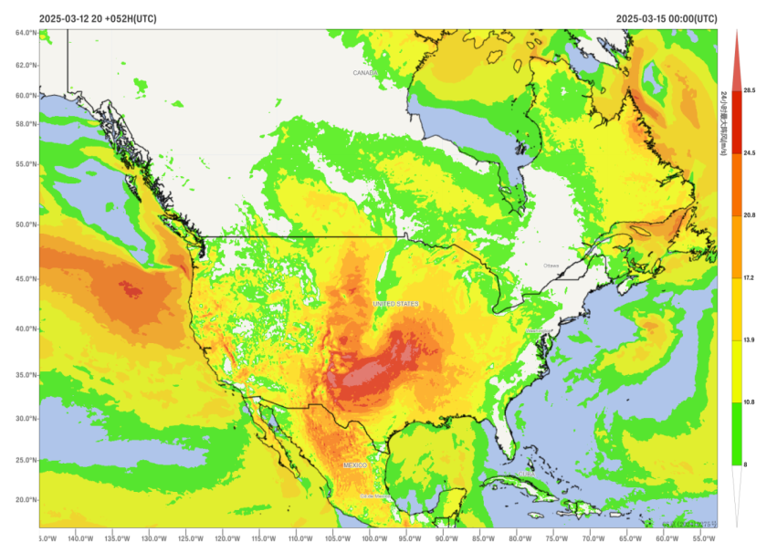
Figure 2: Maximum Gust Speed in a 24-hour Period on March 15, 2025 (Unit: m/s)
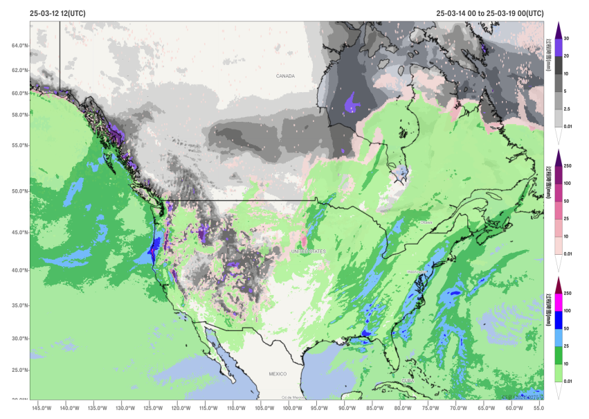
Figure 3: Accumulated precipitation (rain and snow) from March 14 to 18, 2025 (Unit: millimeters)
![]()
Author: Huo Da Reviewer: Niu Ruoyun
English reviewer:Wang Yi Issue approver:Dai Kan