
Extratropical Cyclone Impacts Japan
Affected by a extratropical cyclone cyclone (Figure 1), on December 14th, Japan experienced catastrophic windy conditions. Most regions were hit by gales of 6-7 on the Beaufort scale, with gusts reaching 8-9. In coastal areas and parts of Miyagi Prefecture, localized gusts soared to 9-10 on the Beaufort scale.
From the 15th to the 17th, under the continued influence of the extratropical cyclone, regions including central Japan, Kanto, Tohoku, and Hokkaido will experience strong winds of 6-8 on the Beaufort scale, with localized gusts reaching 9-10 levels (Figure 2). These areas will also see moderate to heavy snowfall, with isolated regions experiencing severe to extreme blizzard conditions. The cumulative snowfall is expected to range from 16 to 30 millimeters, with localized totals reaching 40-50 millimeters (Figure 3). This wind and snow event is of an extreme nature, necessitating attention to the adverse impacts on local power infrastructure, transportation, and other industries.
Additionally, from the 19th to the 20th, influenced by an upper-level trough and cold air, regions including the Kinki area will experience moderate to heavy rain, with localized downpours. These conditions will be accompanied by strong winds of 6-7 on the Beaufort scale, with gusts reaching 8-9 levels.
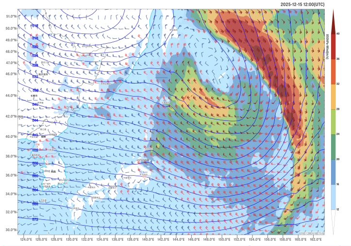
Figure 1 Forecast of 500 hPa Geopotential Height (Unit: dagpm) and 850 hPa Wind Field (Unit: m/s) at 20:00 (UTC) on December 15th
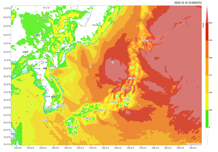
Figure 2 Maximum Gust Speeds in 24 Hours as of 12:00 (UTC) on December 15 (Unit: m/s)
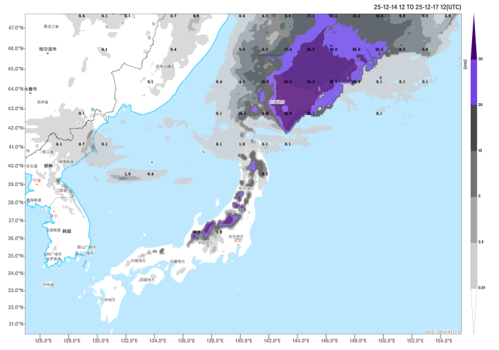
Figure 3 Accumulated Snowfall from 12:00 on December 14 to 12:00 on December 17 (UTC, Unit: mm)
Author: Yan Dachun Reviewer: Liu Xiaobo
English reviewer: Dai Kan Issue approver: Wang Yi