
Eastern Central Asia to Experience Rain, Snow, and Temperature Drop
From November 10 to 13, influenced by the eastward and southward movement of an upper-level low vortex and trough, a rain-snow and cooling event is expected to occur from west to east across eastern Kazakhstan, southeastern West Siberia, and western Mongolia (Figure 1). These regions will experience moderate to heavy snowfall, with localized heavy snow or blizzard conditions. In some areas, cumulative precipitation is expected to exceed 20 mm, with localized totals surpassing 30 mm (Figure 2). Additionally, these areas will also experience a significant drop in temperature, with a decrease of 6 to 10°C in 24 hours, and locally exceeding 12°C (Figure 3). This will be accompanied by strong winds of 4 to 6 on the Beaufort scale, with gusts reaching 7 to 8, and locally up to 9 to 10 (Figure 4). Precautions are advised to mitigate the adverse impacts of the severe weather on local power transmission, shipping and transportation, as well as livestock farming.
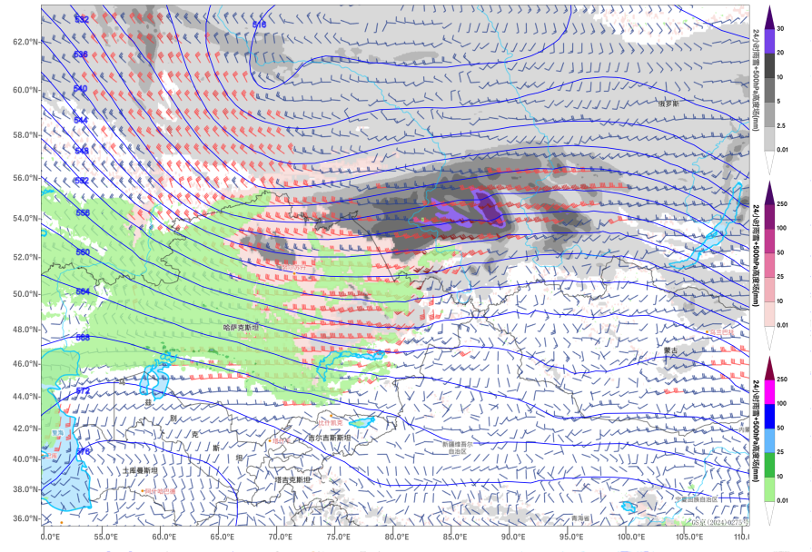
Figure 1: Forecast of 24-hour precipitation (units: mm), 500 hPa geopotential height (units: dagpm), and 850 hPa wind field (units: m/s) at 20:00 (Beijing Time) on November 12
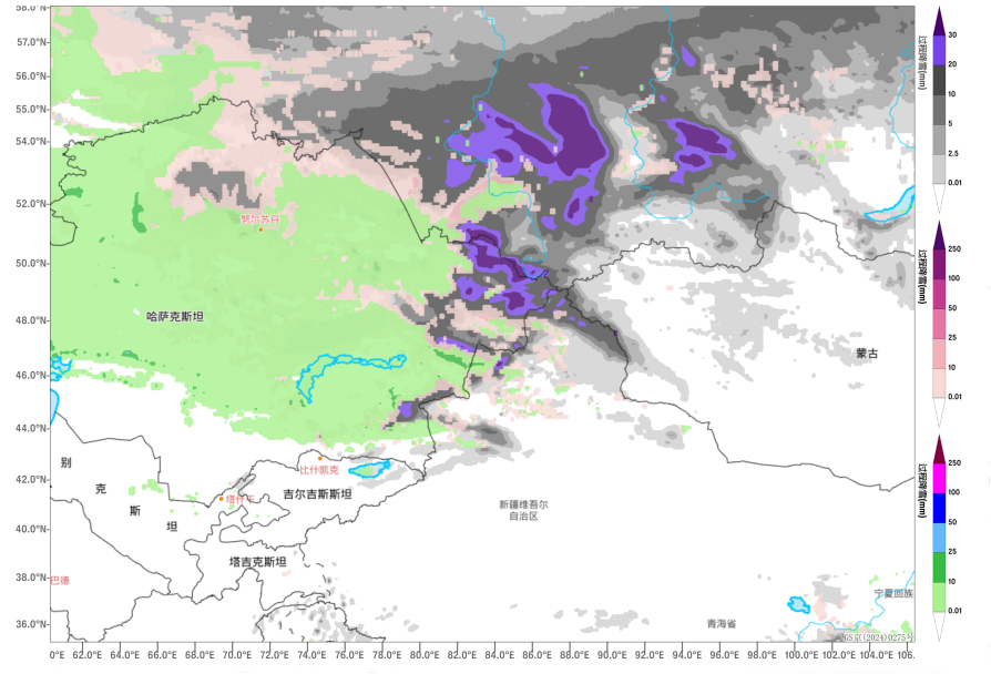
Figure 2: Forecasted Accumulated Precipitation from 20:00 on November 10 to 20:00 on November 13 (Beijing Time) (Unit: mm)
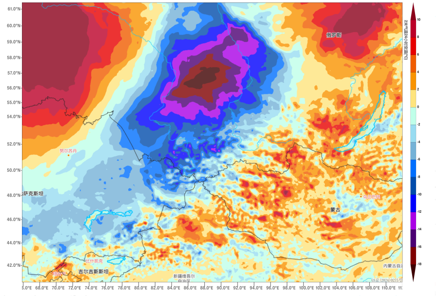
Figure 3: 24-hour Temperature Change Forecast at 2 meters above ground level as of 08:00 (Beijing Time) on November 11 (Unit: °C)
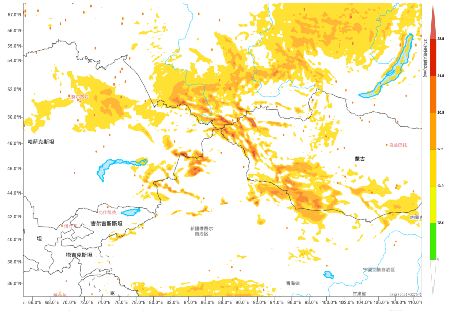
Figure 4: Forecast of Maximum Gust Speed at 20:00 (Beijing Time) on November 11 (Unit: m/s)
![]()
Author: Kong Linghan Reviewer: Zhang Bo
English reviewer:Dai Kan Issue approver:Wang Yi